
File:Tarlac Labelled Map.png
Size of this preview: 509 × 600 pixels. Other resolutions: 204 × 240 pixels | 511 × 602 pixels.
Original file (511 × 602 pixels, file size: 103 KB, MIME type: image/png)
| This is a file from the Wikimedia Commons. Information from its description page there is shown below. Commons is a freely licensed media file repository. You can help. |
Summary
| Description |
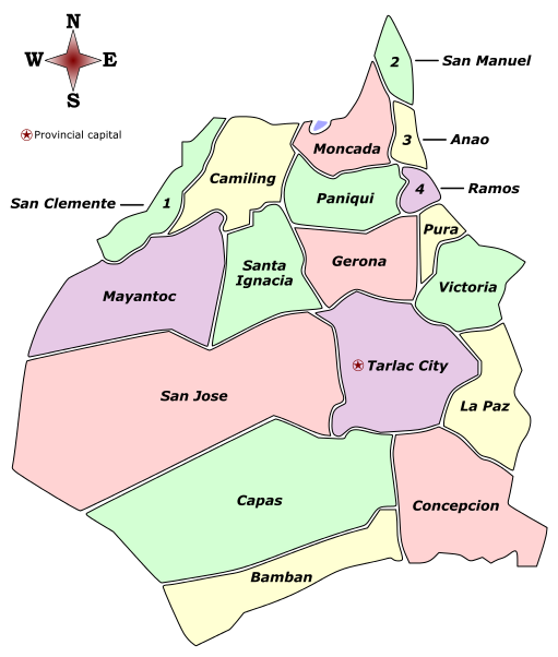
English: Labelled colored map of the province of Tarlac, showing its component city and municipalities. |
| Date | |
| Source |
Map file used: PhlMapCit.svg (as created by Felipe Aira)
|
| Author | James T. (Sanglahi86) |
| Permission (Reusing this file) |
This file is licensed under the Creative Commons Attribution-Share Alike 3.0 Unported license.
|
This map locator image is a derivative work by Sanglahi86 using Felipe Aira's original "PhlMapCit" image, used under Creative Commons Attribution-Share Alike 3.0 Unported.
File history
Click on a date/time to view the file as it appeared at that time.
| Date/Time | Thumbnail | Dimensions | User | Comment | |
|---|---|---|---|---|---|
| current | 06:42, 31 December 2015 | | 511 × 602 (103 KB) | Sanglahi86 | Added gaps between municipality borders. Lightened colors to reduce glaring impact. Added legend and compass (directions) icon. Replaced uppercase labels with normal text. Removed duplicate (redundant number legends). |
| 23:59, 16 February 2015 |  | 511 × 602 (81 KB) | Sanglahi86 | User created page with UploadWizard |
File usage
No pages on the English Wikipedia use this file (pages on other projects are not listed).
Global file usage
The following other wikis use this file:
- Usage on hi.wikipedia.org
- Usage on it.wikipedia.org