
File:Texas Tower 4.jpg

Size of this preview: 741 × 600 pixels. Other resolutions: 297 × 240 pixels | 593 × 480 pixels | 949 × 768 pixels | 1,059 × 857 pixels.
Original file (1,059 × 857 pixels, file size: 304 KB, MIME type: image/jpeg)
| This is a file from the Wikimedia Commons. Information from its description page there is shown below. Commons is a freely licensed media file repository. You can help. |
Summary
| Description |
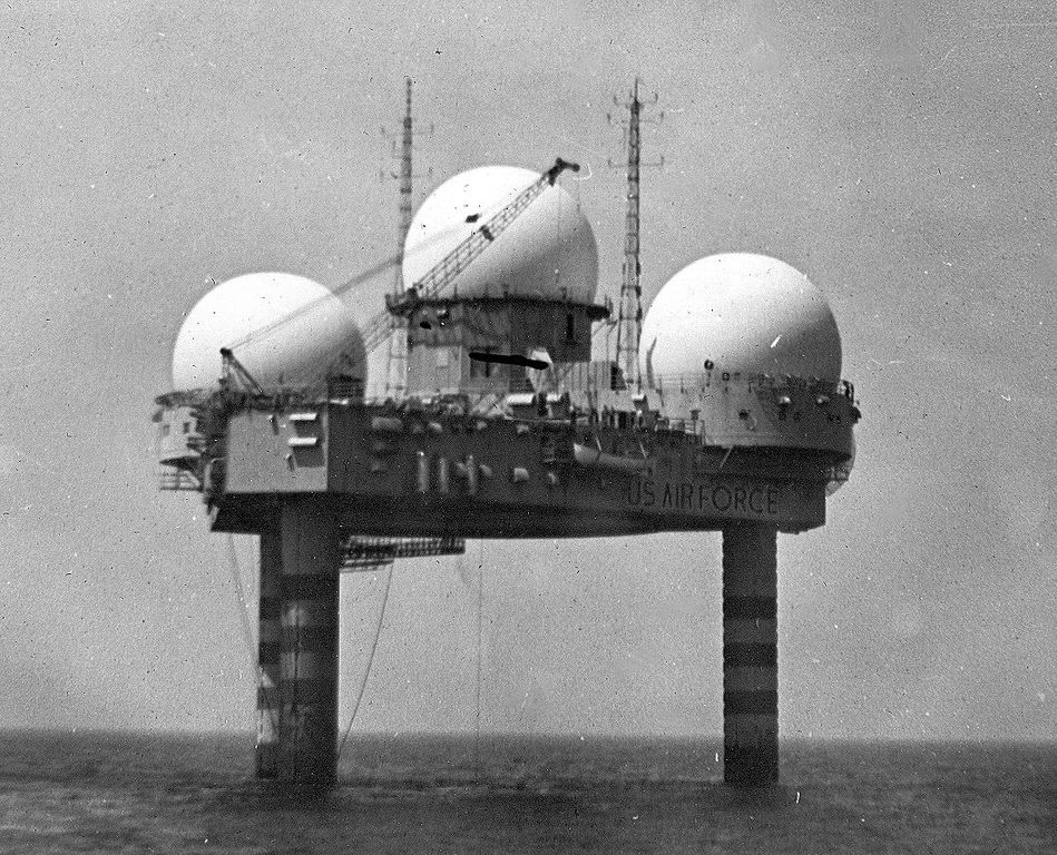
English: Photo of Texas Tower #4 south of Woods Hole, MA. This tower was lost on January 15, 1961, during a storm with a loss of 28 lives. |
| Date | |
| Source | http://www.photolib.noaa.gov/htmls/theb4328.htm |
| Author | NOAA's Historic Coast & Geodetic Survey (C&GS) Collection |
| Permission (Reusing this file) |
USGOV-PD |
Licensing
This image is in the public domain because it contains materials that originally came from the U.S. National Oceanic and Atmospheric Administration, taken or made as part of an employee's official duties.
|
File history
Click on a date/time to view the file as it appeared at that time.
| Date/Time | Thumbnail | Dimensions | User | Comment | |
|---|---|---|---|---|---|
| current | 07:21, 8 January 2011 | | 1,059 × 857 (304 KB) | Bwmoll3 | {{Information |Description={{en|1=Photo of Texas Tower #4 south of Woods Hole, MA. This tower was lost on January 15, 1961, during a storm with a loss of 28 lives.}} |Source=http://www.photolib.noaa.gov/htmls/theb4328.htm |Author=NOAA's Historic Coast & G |
File usage
The following pages on the English Wikipedia use this file (pages on other projects are not listed):
Global file usage
The following other wikis use this file:
- Usage on de.wikipedia.org
- Usage on fr.wikipedia.org
- Usage on www.wikidata.org