
File:Tilgate Parade, Tilgate, Crawley - geograph.org.uk - 23082.jpg
No higher resolution available.
Tilgate_Parade,_Tilgate,_Crawley_-_geograph.org.uk_-_23082.jpg (640 × 480 pixels, file size: 138 KB, MIME type: image/jpeg)
| This is a file from the Wikimedia Commons. Information from its description page there is shown below. Commons is a freely licensed media file repository. You can help. |
Summary
| Description |
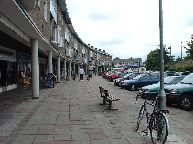
English: Tilgate Parade, Tilgate, Crawley. Tilgate was one of Crawley New Town's original 12 neighbourhoods. Each neighbourhood had its own shops, pub, church etc. Tilgate Parade still commands a position at the centre of everyday life for many people in this neighbourhood (built mid-1950s). |
| Date | |
| Source | From geograph.org.uk |
| Author | Pete Chapman |
| Attribution (required by the license) | Pete Chapman / Tilgate Parade, Tilgate, Crawley / |
| Object location | | View this and other nearby images on: OpenStreetMap |
|---|
_&language=en)
Licensing

|
This image was taken from the Geograph project collection. See this photograph's page on the Geograph website for the photographer's contact details. The copyright on this image is owned by Pete Chapman and is licensed for reuse under the Creative Commons Attribution-ShareAlike 2.0 license.
|
This file is licensed under the Creative Commons Attribution-Share Alike 2.0 Generic license.
Attribution: Pete Chapman
- You are free:
- to share – to copy, distribute and transmit the work
- to remix – to adapt the work
- Under the following conditions:
- attribution – You must give appropriate credit, provide a link to the license, and indicate if changes were made. You may do so in any reasonable manner, but not in any way that suggests the licensor endorses you or your use.
- share alike – If you remix, transform, or build upon the material, you must distribute your contributions under the same or compatible license as the original.
File history
Click on a date/time to view the file as it appeared at that time.
| Date/Time | Thumbnail | Dimensions | User | Comment | |
|---|---|---|---|---|---|
| current | 05:33, 30 January 2010 | | 640 × 480 (138 KB) | GeographBot | == {{int:filedesc}} == {{Information |description={{en|1=Tilgate Parade, Tilgate, Crawley. Tilgate was one of Crawley New Town's original 12 neighbourhoods. Each neighbourhood had its own shops, pub, church etc. Tilgate Parade still commands a position at |
File usage
The following pages on the English Wikipedia use this file (pages on other projects are not listed):
Global file usage
The following other wikis use this file:
- Usage on nl.wikipedia.org