
File:TyphoonTingting2004.jpg

Size of this preview: 490 × 599 pixels. Other resolutions: 196 × 240 pixels | 393 × 480 pixels | 628 × 768 pixels | 838 × 1,024 pixels | 1,676 × 2,048 pixels | 7,200 × 8,800 pixels.
Original file (7,200 × 8,800 pixels, file size: 5.6 MB, MIME type: image/jpeg)
| This is a file from the Wikimedia Commons. Information from its description page there is shown below. Commons is a freely licensed media file repository. You can help. |
| Warning | The original file is very high-resolution. It might not load properly or could cause your browser to freeze when opened at full size. |
|---|
Summary
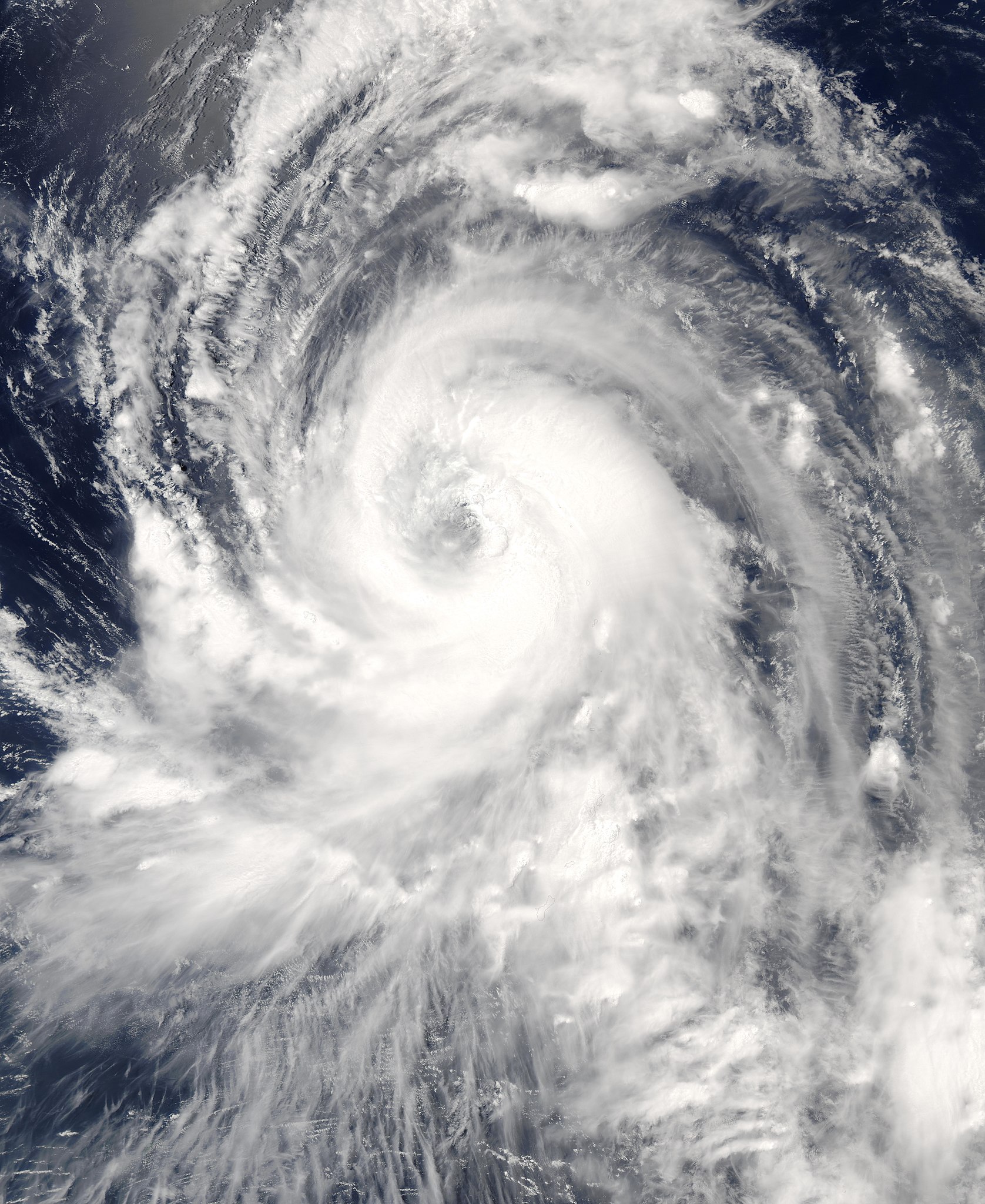
| Description | The MODIS instrument onboard NASA's Aqua (satellite) satellite captured this true-color image of Typhoon Tingting on June 29, 2004 at 3:45 UTC. At that time, Tingting was located approximately 345 miles south-southeast of Iwo Jima and was packing sustained winds of 92 mph with higher gusts to 115 mph. The storm was forecast to strengthen and continue on a west-northwest path. | |||||
| Date | June 30, 2004 | |||||
| Source | http://visibleearth.nasa.gov/view_rec.php?id=6874 | |||||
| Author | Jeff Schmaltz, MODIS Land Rapid Response Team at NASA GSFC. | |||||
| Permission (Reusing this file) |
|

File history
Click on a date/time to view the file as it appeared at that time.
| Date/Time | Thumbnail | Dimensions | User | Comment | |
|---|---|---|---|---|---|
| current | 23:01, 4 September 2006 | | 7,200 × 8,800 (5.6 MB) | Good kitty | higher res... |
| 13:17, 22 August 2006 |  | 3,600 × 4,400 (1.88 MB) | Irfanfaiz | {{Information |Description=The MODIS instrument onboard NASA's Aqua (satellite) satellite captured this true-color image of Typhoon Tingting on June 29, 2004 at 3:45 UTC. At that time, Tingting |
File usage
The following pages on the English Wikipedia use this file (pages on other projects are not listed):
Global file usage
The following other wikis use this file:
- Usage on ja.wikipedia.org
- Usage on th.wikipedia.org
- Usage on vi.wikipedia.org
- Usage on zh.wikipedia.org