
File:U.S. Route 6 in Pennsylvania map.svg

Size of this PNG preview of this SVG file: 800 × 474 pixels. Other resolutions: 320 × 190 pixels | 640 × 379 pixels | 1,024 × 607 pixels | 1,280 × 759 pixels | 2,560 × 1,518 pixels | 2,899 × 1,719 pixels.
Original file (SVG file, nominally 2,899 × 1,719 pixels, file size: 2.64 MB)
| This is a file from the Wikimedia Commons. Information from its description page there is shown below. Commons is a freely licensed media file repository. You can help. |
Summary
| Description |
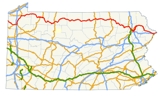
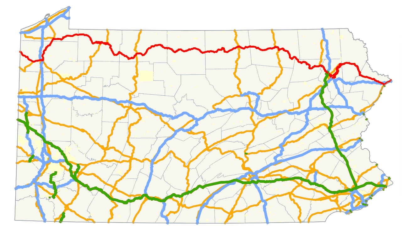
English: Map of U.S. Route 6 in Pennsylvania |
| Date | |
| Source | Own work, GIS data |
| Author |
This W3C-unspecified vector image was created with Inkscape . |
Licensing
| I, the copyright holder of this work, release this work into the public domain. This applies worldwide. In some countries this may not be legally possible; if so: I grant anyone the right to use this work for any purpose, without any conditions, unless such conditions are required by law. |
File history
Click on a date/time to view the file as it appeared at that time.
| Date/Time | Thumbnail | Dimensions | User | Comment | |
|---|---|---|---|---|---|
| current | 21:41, 16 August 2013 | | 2,899 × 1,719 (2.64 MB) | O | {{Information |Description={{en|Map of w:U.S. Route 6 in Pennsylvania}} |Source={{own}}, [ftp://www.pasda.psu.edu/pub/pasda/padot/state/PaStateRoads2013_02.zip GIS data] |Date=2013-08-16 |Author=User:O<br>{{created with Inkscape}} |Permission=... |
File usage
No pages on the English Wikipedia use this file (pages on other projects are not listed).
Global file usage
The following other wikis use this file:
- Usage on www.wikidata.org