
File:Vile Vortices Map.png

No higher resolution available.
Vile_Vortices_Map.png (696 × 291 pixels, file size: 414 KB, MIME type: image/png)
| This is a file from the Wikimedia Commons. Information from its description page there is shown below. Commons is a freely licensed media file repository. You can help. |
Summary
| Description |
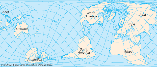
English: Map showing the approximate locations of the Vile Vortices. Français : Carte montrant les emplacements approximatifs des tourbillons géomagnétiques terrestres. |
| Date | 3 March 2006 (original upload date) |
| Source | The Vile Vortice locations (shown in green) were added by the Wikipedia User. |
| Author | Kiwipat at en.wikipedia |
Licensing
| This work has been released into the public domain by its author, Kiwipat at English Wikipedia. This applies worldwide. In some countries this may not be legally possible; if so: Kiwipat grants anyone the right to use this work for any purpose, without any conditions, unless such conditions are required by law. |
| This image is a work of a Central Intelligence Agency employee, taken or made as part of that person's official duties. As a Work of the United States Government, this image or media is in the public domain in the United States.
|

|
This file was reviewed on 20 October 2011 by the administrator or trusted user Magog the Ogre (talk), who confirmed the Public Domain status on that date.
|
Original upload log
The original description page was here. All following user names refer to en.wikipedia.
Upload date | User | Bytes | Dimensions | Comment
- 2009-01-01 22:02 (UTC) | Kiwipat | 424342 (bytes) | 696×291 | best version
- 2009-01-01 20:44 (UTC) | Kiwipat | 45529 (bytes) | 635×272 |
- 2009-01-01 20:29 (UTC) | Kiwipat | 47421 (bytes) | 635×272 |
- 2006-03-03 00:58 (UTC) | Kiwipat | 27838 (bytes) | 635×272 | Map showing the approximate locations of the Vile Vortices. The original map is from the online Perry-Castañeda Library Map Collection. It is posted here courtesy of the University of Texas Libraries, The University of Texas at Austin. The Vile Vortice
File history
Click on a date/time to view the file as it appeared at that time.
| Date/Time | Thumbnail | Dimensions | User | Comment | |
|---|---|---|---|---|---|
| current | 10:00, 11 October 2011 | | 696 × 291 (414 KB) | SreeBot | (Original text) : best version |
| 10:00, 11 October 2011 |  | 635 × 272 (44 KB) | SreeBot | ||
| 10:00, 11 October 2011 |  | 635 × 272 (46 KB) | SreeBot | ||
| 10:00, 11 October 2011 |  | 635 × 272 (27 KB) | SreeBot | (Original text) : Map showing the approximate locations of the Vile Vortices. The original map is from the online Perry-Castañeda Library Map Collection. It is posted here courtesy of the University of Texas Libraries, The University of Texas at Austin. |
File usage
No pages on the English Wikipedia use this file (pages on other projects are not listed).
Global file usage
The following other wikis use this file:
- Usage on es.wikipedia.org
- Usage on fi.wikipedia.org
- Usage on fr.wikipedia.org
- Usage on ro.wikipedia.org