Flúðir
Appearance
Flúðir | |
|---|---|
Village | |
 Flúðir | |
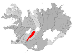
 Location of the Municipality of Hrunamannahreppur | |
| Coordinates: 64°13′N 20°33′W / 64.217°N 20.550°W | |
| Country | |
| Constituency | South Constituency |
| Region | Southern Region |
| Municipality | Hrunamannahreppur |
| Population (2020) | |
| • Total | 818 |
| Time zone | UTC+0 (GMT) |
Flúðir (Icelandic pronunciation: [ˈfluːðɪr̥], sometimes written Fludir) is a village located in the Hrunamannahreppur municipality in the Southern Region, Iceland. It has a population of 818 (as of January 2020). It is not far from Geysir (the geyser first recorded in history) and the Gullfoss waterfall.
References
Wikimedia Commons has media related to Flúðir.

