Heiligerlee railway stop
Heiligerlee | |||||
|---|---|---|---|---|---|
| General information | |||||
| Location | Heiligerlee, Netherlands | ||||
| Coordinates | 53°9′16″N 6°59′55″E / 53.15444°N 6.99861°E | ||||
| Line(s) | Harlingen–Nieuweschans railway | ||||
| Platforms | 2 | ||||
| Tracks | 2 | ||||
| Train operators | Staatsspoorwegen | ||||
| Other information | |||||
| Station code | Hle[1] | ||||
| History | |||||
| Opened | 1 January 1908 | ||||
| Closed | 15 May 1934 | ||||
| |||||
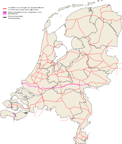
Heiligerlee (Dutch pronunciation: [ˈɦɛilɪɣərˌleː]; abbreviation: Hle) was a railway stop (Dutch: stopplaats) in the village of Heiligerlee in the Netherlands. It was located on the Harlingen–Nieuweschans railway between the railway stations of Scheemda and Winschoten in the province of Groningen. Trains operated by Staatsspoorwegen called at Heiligerlee from 1908 until the railway stop was closed in 1934.
Location
The railway stop was located at 53°09′16″N 06°59′55″E / 53.15444°N 6.99861°E in the village of Heiligerlee in the east of the province of Groningen in the northeast of the Netherlands.[2] It is situated on the Harlingen–Nieuweschans railway between the railway stations of Scheemda in the east and Winschoten in the west.[3]
History
The segment of the Harlingen–Nieuweschans railway between the railway stations of Groningen and Winschoten was opened in 1868.[3] The train services at Heiligerlee started on 1 January 1908[2] and were provided by Maatschappij tot Exploitatie van Staatsspoorwegen.[4] The stop was closed on 15 May 1934.[2]
Layout
The double track railway passed through Heiligerlee from northwest to southeast. The public road crossed the railway just before the railway stop. At the stop, there were two platforms, one north and one south of the tracks.[5]
References
- ^ (in Dutch) Peter Grutter, Lijst van Verkortingen Spoorwegen Archived 2016-06-24 at the Wayback Machine, Nederlandse Vereniging van Belangstellenden in het Spoor- en tramwegwezen, 2015. Retrieved 23 May 2016.
- ^ a b c (in Dutch) Stopplaats Heiligerlee, Stationsweb. Retrieved 4 May 2015.
- ^ a b (in Dutch) Overzicht van de spoorlijn Harlingen-Leeuwarden-Groningen-Nieuweschans, Stationsweb. Retrieved 23 May 2015.
- ^ (in Dutch) SS, Stationsweb. Retrieved on 23 May 2015.
- ^ (in Dutch) Hle Heiligerlee (1916), Sporenplan. Retrieved 23 May 2016.

