Hřiměždice
Hřiměždice | |
|---|---|
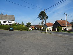
 Vestec, a part of Hřiměždice | |
| Coordinates: 49°41′13″N 14°16′30″E / 49.68694°N 14.27500°E | |
| Country | |
| Region | Central Bohemian |
| District | Příbram |
| First mentioned | 1270 |
| Area | |
• Total | 8.51 km2 (3.29 sq mi) |
| Elevation | 325 m (1,066 ft) |
| Population (2024-01-01)[1] | |
• Total | 376 |
| • Density | 44/km2 (110/sq mi) |
| Time zone | UTC+1 (CET) |
| • Summer (DST) | UTC+2 (CEST) |
| Postal codes | 262 14, 263 01 |
| Website | www |
Hřiměždice is a municipality and village in Příbram District in the Central Bohemian Region of the Czech Republic. It has about 400 inhabitants. It lies on the shore of Slapy Reservoir.
Administrative parts
[edit]The villages of Háje and Vestec are administrative parts of Hřiměždice.
Geography
[edit]Hřiměždice is located about 19 kilometres (12 mi) east of Příbram and 38 km (24 mi) south of Prague. It lies in the Benešov Uplands. The highest point is the hill Na Hvězdáři at 452 m (1,483 ft) above sea level. The municipality is situated on the shore of the Slapy Reservoir, built on the Vltava River.
History
[edit]The first written mention of Hřiměždice is from 1270. Until 1270, the village was owned by the Břevnov Monastery, then King Ottokar II merged it with the Kamýk estate. In the 15th and 16th centuries, Hřiměždice belonged to the Hluboká estate. Jan Vojkovský of Milhostice bought Hřiměždice in 1569 and annexed it to the Zduchovice estate. During the 17th century, the Wratislaw of Mitrovice family and the Strahov Monastery were among the owners of the estate. At the beginning of the 18th century, knight Adam of Mateřov bought Hřimeždice from the monastery and made it the centre of his small estate.[2]
Demographics
[edit]
|
|
| ||||||||||||||||||||||||||||||||||||||||||||||||||||||
| Source: Censuses[3][4] | ||||||||||||||||||||||||||||||||||||||||||||||||||||||||
Transport
[edit]The I/18 road (the section from Příbram to Sedlčany) passes through the municipality.
Sport
[edit]Hřiměždice is known for a flooded quarry after granite mining, which is used for recreation and where an extreme water jumping competition called High Jump is held every year.[5]
Sights
[edit]
The main landmarks of Hřiměždice are the castle and the church. The Church of Saint Anne was originally a chapel from around 1700, which was extended into the church in 1797. It is a simple late Baroque building.[6]
The Hřiměždice Castle was first documented in 1788. It is a small one-story castle in the Baroque and Neoclassical styles. The castle used to have a tower, which was removed during the reconstruction in 1945.[7]
References
[edit]- ^ "Population of Municipalities – 1 January 2024". Czech Statistical Office. 2024-05-17.
- ^ "Historie obce" (in Czech). Obec Hřiměždice. Retrieved 2023-03-09.
- ^ "Historický lexikon obcí České republiky 1869–2011" (in Czech). Czech Statistical Office. 2015-12-21.
- ^ "Population Census 2021: Population by sex". Public Database. Czech Statistical Office. 2021-03-27.
- ^ "Lom Hříměždice – ráj pro milovníky skoků z výšky" (in Czech). CzechTourism. Retrieved 2023-03-09.
- ^ "Kostel sv. Anny" (in Czech). National Heritage Institute. Retrieved 2023-03-09.
- ^ "Zámek Hřiměždice" (in Czech). National Heritage Institute. Retrieved 2023-03-09.


