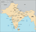
File:Map of British India anachronous.png
Appearance

Size of this preview: 684 × 599 pixels. Other resolutions: 274 × 240 pixels | 548 × 480 pixels | 913 × 800 pixels.
Original file (913 × 800 pixels, file size: 359 KB, MIME type: image/png)
File history
Click on a date/time to view the file as it appeared at that time.
| Date/Time | Thumbnail | Dimensions | User | Comment | |
|---|---|---|---|---|---|
| current | 17:37, 20 March 2019 |  | 913 × 800 (359 KB) | Blackknight12 | Sri Lanka not a part of British India |
| 08:43, 5 June 2006 |  | 913 × 800 (159 KB) | Ambuj.Saxena | Cropped version of en:Image:India-partition.GIF to illustrate British India. {{PD-user-en|Deepak gupta}} |
File usage
The following 6 pages use this file:
Global file usage
The following other wikis use this file:
- Usage on cs.wikipedia.org
- Usage on hi.wikisource.org
- Usage on kn.wikipedia.org
- Usage on zh.wikipedia.org
