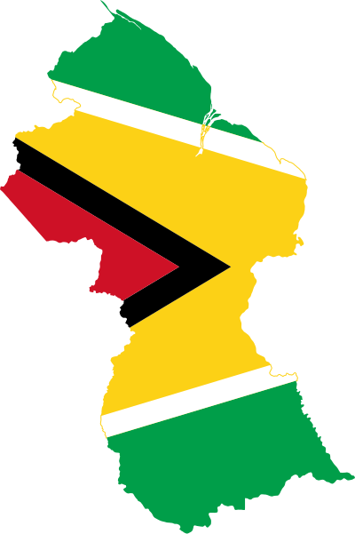
File:Flag-map of Guyana.svg
Appearance

Size of this PNG preview of this SVG file: 400 × 600 pixels. Other resolutions: 160 × 240 pixels | 320 × 480 pixels | 512 × 768 pixels | 682 × 1,024 pixels | 1,365 × 2,048 pixels.
Original file (SVG file, nominally 400 × 600 pixels, file size: 268 KB)
File history
Click on a date/time to view the file as it appeared at that time.
| Date/Time | Thumbnail | Dimensions | User | Comment | |
|---|---|---|---|---|---|
| current | 18:30, 12 April 2016 |  | 400 × 600 (268 KB) | Stasyan117 | Reverted to version as of 14:56, 17 May 2015 (UTC) |
| 00:35, 15 January 2016 |  | 641 × 1,100 (11 KB) | Dim Grits | Reverted to version as of 20:06, 23 May 2008 (UTC) | |
| 14:56, 17 May 2015 |  | 400 × 600 (268 KB) | Stasyan117 | Reduce | |
| 23:18, 27 January 2015 |  | 512 × 769 (26 KB) | Stasyan117 | Reduce | |
| 14:45, 4 December 2008 |  | 813 × 1,220 (119 KB) | Darwinek | more correct borders | |
| 20:06, 23 May 2008 |  | 641 × 1,100 (11 KB) | Darwinek |
File usage
The following 99 pages use this file:
- Abary
- Acarai Mountains
- Adventure, Guyana
- Amaila Falls
- Anna Regina
- Annandale, Demerara-Mahaica
- Annandale, Pomeroon-Supenaam
- Apoteri
- Arakaka
- Awarewaunau
- Baramita
- Belfield, Guyana
- Beterverwagting
- Better Hope
- Burma, Guyana
- Bush Lot
- Cane Grove
- Catherinas Lust
- Corocoro Island
- Crab Island, Guyana
- El Paso, Guyana
- Esau and Jacob
- Fort Wellington, Guyana
- Goed Fortuin
- Governor Light
- Hackney, Guyana
- Helena, Guyana
- Hiawa
- Hogg Island, Guyana
- Hosororo
- Hyde Park, Guyana
- Imataka Mountains
- Imbaimadai
- Jonestown, Mahaica
- Kamarang
- Kamwatta Hill
- Karinambo
- Kartabo, Guyana
- Kato, Guyana
- Katoonarib
- King Edward VIII Falls
- Koriabo
- Kumaka, Barima-Waini
- Kumaka, East Berbice-Corentyne
- Kurupung
- Kwakwani
- Kwebanna
- Lima Sands
- Long Creek, Guyana
- Mahaica
- Met-en-Meerzorg
- Monte Caburaí
- Mora Point
- Mount Venamo
- Mount Wokomung
- Murrays Fall
- New Andalusia Province
- Noitgedacht
- Onderneeming
- Orinduik
- Orinduik Falls
- Paradise, Guyana
- Parika
- Pickersgill, Guyana
- Plaisance, Guyana
- Providence, Guyana
- Rappu Falls
- Rose Hall, Guyana
- Saxacalli
- Serra do Acari
- Seweyo
- Shell Beach, Guyana
- Silver Hill, Guyana
- Skeldon, Guyana
- Soesdyke-Linden Highway
- Spring Garden, Guyana
- Suddie
- Supenaam
- Timehri
- Toka, Guyana
- Torani Canal
- Toroparu mine
- Tumatumari Landing
- Vriesland, Guyana
- Wakapau
- Weldaad
- Whitewater, Guyana
- Wichabai
- Yupukari
- Zeeburg, Guyana
- Zeelandia, Guyana
- User:Dwscomet/My userbox creations
- User:Dwscomet/My userbox creations/GuyaneseAncestry
- User:Klgh07
- User:Underdwarf58
- User:Underdwarf58/Userboxes/EssequiboGuyana
- Wikipedia:Graphics Lab/Image workshop/Archive/Feb 2009
- Wikipedia:Userboxes/Life/Ancestry/02
- Template:Guyana-geo-stub
Global file usage
The following other wikis use this file:
- Usage on ar.wikinews.org
- Usage on bg.wikipedia.org
- Usage on cs.wikipedia.org
- Usage on de.wikipedia.org
- Usage on es.wikipedia.org
- Usage on kbd.wikipedia.org
- Usage on ko.wikipedia.org
- Usage on lv.wikipedia.org
- Usage on pt.wikipedia.org
- Usage on uk.wikipedia.org
View more global usage of this file.

