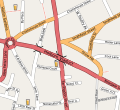
File:Holborn-viaduct-map.svg
Appearance

Size of this PNG preview of this SVG file: 654 × 599 pixels. Other resolutions: 262 × 240 pixels | 524 × 480 pixels | 838 × 768 pixels | 1,117 × 1,024 pixels | 2,235 × 2,048 pixels | 671 × 615 pixels.
Original file (SVG file, nominally 671 × 615 pixels, file size: 269 KB)
File history
Click on a date/time to view the file as it appeared at that time.
| Date/Time | Thumbnail | Dimensions | User | Comment | |
|---|---|---|---|---|---|
| current | 09:51, 31 December 2013 |  | 671 × 615 (269 KB) | Ysangkok | scour |
| 14:52, 22 April 2008 |  | 671 × 615 (1.09 MB) | Harry Wood | this SVG renderer didn't like the oneway arrows. Remove them | |
| 14:42, 22 April 2008 |  | 671 × 615 (1.11 MB) | Harry Wood | try to fix 'page' boundary | |
| 14:39, 22 April 2008 |  | 671 × 615 (1.08 MB) | Harry Wood | {{Information |Description=Map of the area around Holborn Viaduct |Source=OpenStreetMap.org |Date= |Author= |Permission={{OpenStreetMap}} |other_versions= }} |
File usage
The following 2 pages use this file:
Global file usage
The following other wikis use this file:
- Usage on de.wikipedia.org
- Usage on fr.wikipedia.org
- Usage on tg.wikipedia.org
