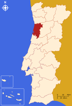
File:LocalDistritoAveiro.svg
Appearance

Size of this PNG preview of this SVG file: 250 × 366 pixels. Other resolutions: 164 × 240 pixels | 328 × 480 pixels | 524 × 768 pixels | 699 × 1,024 pixels | 1,399 × 2,048 pixels.
Original file (SVG file, nominally 250 × 366 pixels, file size: 216 KB)
File history
Click on a date/time to view the file as it appeared at that time.
| Date/Time | Thumbnail | Dimensions | User | Comment | |
|---|---|---|---|---|---|
| current | 18:48, 5 January 2006 |  | 250 × 366 (216 KB) | Rei-artur | == Descrição do ficheiro == Imagem criada por '''Rei-artur''', em Janeiro de 2005, a partir do mapa Image:Mapa de Portugal completo. {{User:Rei-artur/by}} Category:Maps of districts in Portugal == Licensing == {{self2|GFDL| |
File usage
The following page uses this file:
Global file usage
The following other wikis use this file:
- Usage on an.wikipedia.org
- Usage on br.wikipedia.org
- Usage on de.wikipedia.org
- Aveiro (Portugal)
- Águeda
- Castelo de Paiva
- Espinho
- Arouca (Portugal)
- Santa Maria da Feira
- Ovar (Portugal)
- Estarreja
- Albergaria-a-Velha
- Anadia
- Oliveira de Azeméis
- São João da Madeira
- Vale de Cambra
- Sever do Vouga
- Murtosa
- Ílhavo
- Vagos
- Mealhada
- Oliveira do Bairro
- Vorlage:Navigationsleiste Kreise im Distrikt Aveiro
- Usage on fa.wikipedia.org
- Usage on frr.wikipedia.org
- Usage on hy.wikipedia.org
- Usage on id.wikipedia.org
- Usage on it.wikivoyage.org
- Usage on ja.wikipedia.org
- Usage on ko.wikipedia.org
- Usage on lt.wikipedia.org
- Usage on ms.wikipedia.org
- Usage on mwl.wikipedia.org
- Usage on pl.wikipedia.org
View more global usage of this file.

