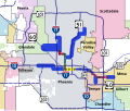
File:Maricopa County METRO Light Rail Map.svg
Appearance

Size of this PNG preview of this SVG file: 650 × 550 pixels. Other resolutions: 284 × 240 pixels | 567 × 480 pixels | 908 × 768 pixels | 1,210 × 1,024 pixels | 2,420 × 2,048 pixels.
Original file (SVG file, nominally 650 × 550 pixels, file size: 403 KB)
File history
Click on a date/time to view the file as it appeared at that time.
| Date/Time | Thumbnail | Dimensions | User | Comment | |
|---|---|---|---|---|---|
| current | 03:31, 24 September 2007 |  | 650 × 550 (403 KB) | Ixnayonthetimmay | |
| 03:22, 24 September 2007 |  | 650 × 550 (404 KB) | Ixnayonthetimmay | ||
| 03:19, 24 September 2007 |  | 650 × 550 (403 KB) | Ixnayonthetimmay | ||
| 03:15, 24 September 2007 |  | 650 × 550 (392 KB) | Ixnayonthetimmay | {{Information |Description=Geographical map of METRO Light Rail system of Phoenix, Arizona, showing the starter route and future expansion corridors. Also shown are city borders a |
File usage
The following page uses this file:
Global file usage
The following other wikis use this file:
- Usage on ja.wikipedia.org
- Usage on pl.wikipedia.org
- Usage on ru.wikipedia.org
- Usage on zh.wikipedia.org
