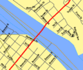
File:Mid-Delaware Bridge map.gif
Appearance
Mid-Delaware_Bridge_map.gif (422 × 359 pixels, file size: 15 KB, MIME type: image/gif)
File history
Click on a date/time to view the file as it appeared at that time.
| Date/Time | Thumbnail | Dimensions | User | Comment | |
|---|---|---|---|---|---|
| current | 18:15, 15 January 2008 |  | 422 × 359 (15 KB) | File Upload Bot (Magnus Manske) | {{BotMoveToCommons|en.wikipedia}} {{Information |Description={{en|Created by Daniel Case using the Census Bureau's TIGER mapping system here:[http://tiger.census.gov/cgi-bin/mapper/map.gif?&lat=41.37154&lon=-74.69672&ht=0.007&wid |
File usage
No pages on the English Wikipedia use this file (pages on other projects are not listed).
Global file usage
The following other wikis use this file:
- Usage on de.wikipedia.org
- Usage on www.wikidata.org


