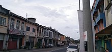
Johol


Johol (Jawi: جوهول) is a town, a mukim and a state assembly constituency in Kuala Pilah District, Negeri Sembilan, Malaysia.[1] It is roughly halfway between Tampin and Kuala Pilah, along Highway ![]() FT 9.
FT 9.
Features
Johol town houses one of the oldest surviving Shell service stations in the country, dating back to the 1930s. It is located along Jalan Besar (highway 9).[2]
Politics
Johol is one of the constituent Minangkabau states, known as luaks, that formed Negeri Sembilan. The reigning Undang Luak of Johol is Datuk Johan Pahlawan Lela Perkasa Setiawan Muhammad Abdullah (The 15th Undang).[3] He is one of the four Undangs that will participate in the election of the Yamtuan Besar of Negeri Sembilan; the other three are from Sungai Ujong (which included the capital Seremban and Port Dickson), Jelebu and Rembau.
Johol is part of the parliamentary constituency of Kuala Pilah. Johol is also a constituency of the Negeri Sembilan State Legislative Assembly.
References
- ^ "Toponymic Guidelines for Map and Other Editors for International Use" (PDF). Malaysian National Committee on Geographical Names. 2017. p. 32. Archived from the original (PDF) on May 22, 2021. Retrieved May 29, 2021.
{{cite web}}:|archive-date=/|archive-url=timestamp mismatch; May 23, 2021 suggested (help) - ^ "Stesen minyak tertua tetap teguh". Harian Metro. 28 Jun 2017. Retrieved 24 Feb 2019.
- ^ "Istiadat menghadap Undang Luak Johol di Istana Seri Menanti". 15 December 2016.
2°36′N 102°16′E / 2.600°N 102.267°E
