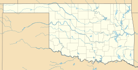
Keystone State Park (Oklahoma)
| Keystone State Park | |
|---|---|
 Shoreline view at Keystone State Park, Oklahoma | |
| Location | Tulsa County, Oklahoma, United States |
| Nearest city | Sand Springs, OK |
| Coordinates | 36°08′26″N 96°16′05″W / 36.1406365°N 96.2680648°W[1] |
| Area | 714 acres (289 ha) |
| Governing body | Oklahoma Tourism and Recreation Department |
| www | |
Keystone State Park is an Oklahoma state park near Sand Springs, Tulsa County, Oklahoma, in the United States. The park provides recreational opportunities in fishing, swimming, water skiing and boating. Cabins are available to rent. Keystone State Park is on State Highway 151 near Mannford.[2]
References
- ^ "Keystone State Park". Geographic Names Information System. United States Geological Survey, United States Department of the Interior. Retrieved January 6, 2013.
- ^ "Keystone State Park". Oklahoma Tourism and Recreation Department. Retrieved January 6, 2013.

