
Kyläniemi
 Kyläniemi ferry | |
 | |
| Geography | |
|---|---|
| Location | Taipalsaari South Karelia Finland |
| Coordinates | 61°18′22.396″N 28°14′6.587″E / 61.30622111°N 28.23516306°E |
| Adjacent to | Lake Saimaa |
| Length | 14 km (8.7 mi) |
Kyläniemi is an island on the south of lake Saimaa in Taipalsaari. It was formed during the second Salpausselkä.[1] Kyläniemi is the 20th largest island in Finland's inland waters, with an area of 23 km2.[2]
Kyläniemi used to be a peninsula, until the construction of Kutvele canal in the 18nth century turned it to an island. The island can be reached via the road connection at Ruokohlati and via Kyläniemi ferry.[1]
Geography[edit]
The 14 km long island consists of sandy beaches, terraces, gravelly deltas and end moraine ridges. Kyläniemi emerged during the second Salpausselkä ice-marginal formation, and pasqueflowers and sand pink flowers were among the first plant species to appear on the island. A variety of plants that can be found includes anemone, sand pansy and canary grass. The island also harbors sparsely wooded coniferous forests.[3][4][5][6][7]
Kyläniemi is considered a significant geological and biological ridge area. It is protected under the national ridge protection program and the Natura 2000 network of preserved natural sites.[8][1]
Gallery[edit]
-
 Kyläsalmi cable ferry. Kutvele canal lies in the background.
 -
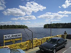
 Kyläniemi ferry
 -
 Kyläniemi beach


References[edit]
- ^ a b c "Saimaa Geopark". Taipalsaari (in Finnish). Retrieved 24 April 2021.
- ^ "Saarten ja vetten maa". Retrieved 24 April 2021.
- ^ Kyläniemi 3">"Ymparisto > Kyläniemi". www.ymparisto.fi (in Finnish). Retrieved 24 April 2021.
- ^ "Kyläniemi ice-marginal formation". www.outdooractive.com. Retrieved 24 April 2021.
- ^ "Kyläniemi". www.kylaniemi.fi. Retrieved 24 April 2021.
- ^ "Kyläniemi (Rastiniemi)". Veneilysaimaa (in Finnish). Retrieved 24 April 2021.
- ^ "Ymparisto > Kyläniemi". www.ymparisto.fi (in Finnish). Retrieved 24 April 2021.
- ^ "Toimenpidesuunnitelma Taipalsaaren Kyläniemen Natura 2000 –alueella (FI0422005) tilalla Vaiviola (4:128) ja Ahola (4:28)" (PDF). Retrieved 24 April 2021.