La Pedriza


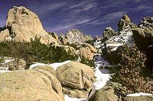
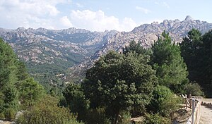
La Pedriza is a geological feature of great scenic and leisure interest. It is located on the southern slopes of the Guadarrama mountain range. Access is from Manzanares el Real, a municipality northwest of the Community of Madrid (Spain). It is one of the largest granitic ranges of Europe and holds numerous peaks, rocky cliffs, streams and meadows.
Geological forces have created a remarkable boulder field of strangely eroded granitic outcrops. Nearly a thousand rock climbing routes of all difficulties are available to rock climbers. Hiking is also popular in La Pedriza, especially on weekends.
The 32 square kilometres occupied by La Pedriza lie within the Regional Park of the High River basin of Manzanares, the largest park of the Community of Madrid. In this zone, vegetation is sparse, but there are Mediterranean shrubs like the rockrose, and alpine varieties like fabaceaes. The fauna is rich in birds of prey; the breeding colony of over 100 pairs of Griffon Vultures is the largest in the Madrid area.


