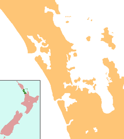
Lake Kuwakatai
| Lake Kuwakatai | |
|---|---|
 April view of Lake Kuwakatai | |
| Location | Auckland |
| Coordinates | 36°31′40″S 174°14′29″E / 36.527821°S 174.241276°E |
| Primary outflows | none |
| Basin countries | New Zealand |
| Surface area | 36 hectares (89 acres) |
| Surface elevation | 58 metres (190 ft) |
Lake Kuwakatai is a small dune lake located on the south head of Kaipara Harbour in New Zealand. It is located 0.5 kilometres (0.31 mi) south of the larger Lake Rototoa[1] It has a surface area of 0.36 square kilometres (89 acres)
References
- ^ New Zealand 1:50000 Topographic Map Series sheet AZ30 – Kaipara Harbour

