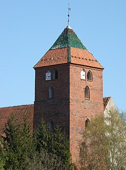
Młynary
Młynary | |
|---|---|
 | |
| Country | |
| Voivodeship | Warmian-Masurian |
| County | Elbląg |
| Gmina | Młynary |
| Area | |
| • Total | 2.76 km2 (1.07 sq mi) |
| Elevation | 53 m (174 ft) |
| Population (2006) | |
| • Total | 1,837 |
| • Density | 670/km2 (1,700/sq mi) |
| Postal code | 14-420 |
| Website | www.mlynary.pl |
Młynary [mwɨˈnarɨ] (German: Mühlhausen in Ostpreußen) is a town in Elbląg County, Warmian-Masurian Voivodeship, Poland, with 1,844 inhabitants (2004). This makes it the smallest of the 49 towns in the voivodeship.
Before 1945 the area was part of Germany (East Prussia). After World War II the region was placed under Polish administration and ethnically cleansed according to the post-war Potsdam Agreement. The native German populace was expelled and replaced with Poles.
People
- Maciej Płażyński, Polish politician
54°11′18″N 19°43′30″E / 54.18833°N 19.72500°E


