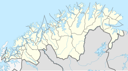
Nordfugløya
Appearance
 | |
| Geography | |
|---|---|
| Location | Troms og Finnmark, Norway |
| Coordinates | 70°14′30″N 20°13′37″E / 70.2417°N 20.2270°E |
| Area | 21.3 km2 (8.2 sq mi) |
| Highest elevation | 750 m (2460 ft) |
| Highest point | Fugløykallen |
| Administration | |
Norway | |
| County | Troms og Finnmark |
| Municipality | Karlsøy Municipality |
Nord-Fugløya or Fugløya is an uninhabited island in Karlsøy Municipality in Troms og Finnmark, Norway. The highest mountain is the 750-metre (2,460 ft) tall Fugløykallen. Fugløykalven Lighthouse is located north of the island.[1][2]
Nature reserve
The whole island is protected as a nature reserve which, along with the adjacent marine waters, has also been designated a Important Bird Area (IBA) by BirdLife International because it supports large breeding colonies of Atlantic puffins and razorbills.[3]
See also
References
- ^ Evensen, Knut Harald, ed. (2010). NAF Veibok 2010-2012 (in Norwegian) (29th ed.). Oslo: Norges Automobil-Forbund. p. 134.
- ^ Godal, Anne Marit (ed.). "Nord-Fugløya". Store norske leksikon (in Norwegian). Oslo: Norsk nettleksikon. Retrieved 2 August 2013.
- ^ "Nord-Fugløy". BirdLife Data Zone. BirdLife International. 2021. Retrieved 2021-12-08.


