Pambak (river)
Appearance
You can help expand this article with text translated from the corresponding article in Russian. (September 2013) Click [show] for important translation instructions.
|
| Pambak | |
|---|---|
 The Pambak flowing towards the city of Vanadzor | |
| Location | |
| Country | Armenia |
| Province | Lori |
| Physical characteristics | |
| Source | |
| • location | Pambak Mountains |
| • elevation | 2,200 m (7,200 ft) |
| Mouth | Debed |
• location | Near Dzoragyukh |
• coordinates | 40°57′26″N 44°37′57″E / 40.95722°N 44.63250°E |
| Length | 86 km (53 mi) |
| Basin size | 1,370 km2 (530 sq mi) |
| Basin features | |
| Progression | Debed→ Khrami→ Kura→ Caspian Sea |
| Tributaries | |
| • right | Tandzut |

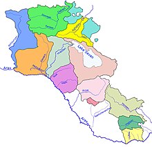
The Pambak (Armenian: Փամբակ), is a river in the region of Lori Province in Northern Armenia and a tributary of the Debed river. It originates in the Pambak Mountains and flows west to east through spectacular gorges around Bazum Mountains. It finally feeds into the Debed river near Dzoragyugh, which ultimately drains to the Kura.[1]
References
- ^ Sosson, M. (15 October 2010). SP340 - Sedimentary Basin Tectonics - Black Sea. Geological Society. p. 396. ISBN 978-1-86239-308-0. Retrieved 30 December 2012.
