
Pogwizdów, Lower Silesian Voivodeship
Pogwizdów | |
|---|---|
Village | |
_(0024).jpg) View of Pogwizdów with the Exaltation of the Holy Cross church | |
 Pogwizdów Location of Pogwizdów, Lower Silesian Voivodeship  Pogwizdów Pogwizdów (Lower Silesian Voivodeship) | |
| Coordinates: 50°57′53″N 16°05′34″E / 50.96472°N 16.09278°E | |
| Country | |
| Voivodeship | Lower Silesian |
| Powiat | Jawor |
| Gmina | Paszowice |
| First mentioned | 13th century |
| Time zone | UTC+1 (CET) |
| • Summer (DST) | UTC+2 (CEST) |
| Vehicle registration | DJA |
Pogwizdów [pɔɡˈvizduf] is a village in the administrative district of Gmina Paszowice, within Jawor County, Lower Silesian Voivodeship, in south-western Poland.[1]
It lies approximately 12 km (7 mi) south-west of Jawor, and 69 km (43 mi) west of the regional capital Wrocław.
History[edit]
The village was first mentioned in the 13th century, when it was part of fragmented Piast-ruled Poland. The village's oldest heritage monument, the Romanesque Exaltation of the Holy Cross church, was built in the 13th century. In the 18th century the village was annexed by Prussia, and from 1871 to 1945 it also formed part of Germany. During World War II, a German forced labour subcamp of the prison in Jawor was operated in the village.[2] After the defeat of Nazi Germany in the war in 1945, the village became again part of Poland.
Gallery[edit]
-
 Cornfield
 -
 School
 -
 Church of the Ascension of Christ
 -
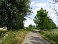 Road
Road
.jpg)
.jpg)

.jpg)
References[edit]
- ^ "Central Statistical Office (GUS) – TERYT (National Register of Territorial Land Apportionment Journal)" (in Polish). 2008-06-01.
- ^ "Außenkommando "von Loesch" des Zuchthauses Jauer in Langhelwigsdorf". Bundesarchiv.de (in German). Retrieved 29 November 2020.
This Jawor County location article is a stub. You can help Wikipedia by expanding it. |