Radzików-Stopki
Radzików-Stopki | |
|---|---|
Village | |
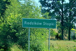
 Road sign in Radzików-Stopki | |
| Coordinates: 52°09′22″N 22°30′07″E / 52.15611°N 22.50194°E | |
| Country | |
| Voivodeship | Masovian |
| County | Siedlce |
| Gmina | Mordy |
| Vehicle registration | WSI |
Radzików-Stopki (Polish pronunciation: [raˈdʑikuf ˈstɔpkʲi]) is a village in the administrative district of Gmina Mordy, within Siedlce County, Masovian Voivodeship, in east-central Poland.[1]
History[edit]
In 1827 the village had a population of 109.[2]
Following the joint German-Soviet invasion of Poland, which started World War II in September 1939, the village was occupied by Germany. On April 10, 1943, the German gendarmerie executed three Poles, aged 30, 35 and 70, accused of sheltering Jews and Soviet POWs who escaped from German captivity.[3]
See also[edit]
References[edit]
- ^ "Central Statistical Office (GUS) – TERYT (National Register of Territorial Land Apportionment Journal)" (in Polish). 2008-06-01.
- ^ Słownik geograficzny Królestwa Polskiego i innych krajów słowiańskich, Tom IX (in Polish). Warszawa. 1888. p. 471.
{{cite book}}: CS1 maint: location missing publisher (link) - ^ Datner, Szymon (1968). Las sprawiedliwych (in Polish). Warszawa: Książka i Wiedza. p. 95.


