
Rindoon
Rinn Dúin | |
 Rindoon town wall | |
 Shown within Ireland | |
| Alternative name | Rindown, Rinndown |
|---|---|
| Location | Warren, St. John's, County Roscommon, Ireland |
| Coordinates | 53°32′20″N 7°59′29″W / 53.538901°N 7.991500°W |
| Type | Abandoned village |
| History | |
| Founded | early 13th century AD |
| Abandoned | early 14th centuries |
| Periods | Medieval Ireland |
Rindoon (Irish: Rinn Dúin) is an abandoned village located in County Roscommon, Ireland.
Location
[edit]Rindoon is located on a headland reaching into Lough Ree, 4 km east of Lecarrow.
History and archaeology
[edit]Rindoon was built in the first half of the 13th century AD, i.e. 1200–50.[1] The castle at Rindoon is thought to date to 1227 and was constructed by Geoffrey de Marisco.[2] With the Gaelic resurgence of the late 13th and early 14th centuries the town was sacked and later completely abandoned.[3]
Gallery
[edit]-
 Rindoon Castle
 -
 Rindoon Castle main entrance
 -
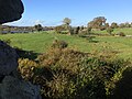 Rindoon, view from the castle
 -
 Rindoon Church
 -
 Rindoon Harbour


References
[edit]- ^ "History of Rindoon". Archived from the original on 6 May 2017. Retrieved 23 October 2015.
- ^ "Rindoon Deserted Medieval Town, County Roscommon".
- ^ "Rindoon Deserted Medieval Town, County Roscommon".
External links
[edit]Wikimedia Commons has media related to Rindoon.
- Rindoon on the Irish Walled Towns Network website Archived 16 February 2020 at the Wayback Machine
This article related to the geography of County Roscommon, Ireland is a stub. You can help Wikipedia by expanding it. |