Jump to content

Ruahara

Coordinates: 8°55′50.84″S 157°58′16.79″W / 8.9307889°S 157.9713306°W / -8.9307889; -157.9713306
From Wikipedia, the free encyclopedia

This is an old revision of this page, as edited by JJMC89 bot III (talk | contribs) at 03:48, 19 March 2021 (Moving Category:Penrhyn (atoll) to Category:Penrhyn atoll per Wikipedia:Categories for discussion/Speedy). The present address (URL) is a permanent link to this revision, which may differ significantly from the current revision.

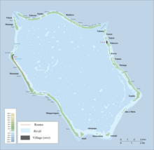
Map of Penrhyn Atoll

Ruahara is an islet in Penrhyn Atoll (Tongareva) in the Cook Islands. It is on the northern edge of the atoll, between Takuua and Painko. The island was once inhabited and contains two marae, Te Tohi and Sivalau.[1]

References

  1. ^ Te Rangi Hiroa (April 1932). Ethnology of Tongareva. Honolulu: Bernice P. Bishop Museum. p. 160-161. Retrieved 21 August 2020 – via NZETC.

8°55′50.84″S 157°58′16.79″W / 8.9307889°S 157.9713306°W / -8.9307889; -157.9713306