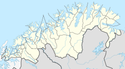
Skøelva
Appearance
Skøelva
Skøelv | |
|---|---|
Village | |
| Coordinates: 69°07′54″N 18°03′01″E / 69.13167°N 18.05028°E | |
| Country | Norway |
| Region | Northern Norway |
| County | Troms og Finnmark |
| District | Midt-Troms |
| Municipality | Sørreisa Municipality |
| Elevation | 6 m (20 ft) |
| Time zone | UTC+01:00 (CET) |
| • Summer (DST) | UTC+02:00 (CEST) |
| Post Code | 9310 Sørreisa |
Skøelva or Skøelv is the second largest village in Sørreisa Municipality in Troms og Finnmark county, Norway. The village is located along the Reisafjorden, about 5 kilometres (3.1 mi) west of the municipal centre of Sørreisa. The village is located along the mouth of the river Skøelva. Skøelv Chapel is located in the village.
References


