
Swink, Oklahoma
Swink, Oklahoma | |
|---|---|
 Location of Swink, Oklahoma | |
| Coordinates: 34°1′6″N 95°12′10″W / 34.01833°N 95.20278°W | |
| Country | United States |
| State | Oklahoma |
| County | Choctaw |
| Area | |
| • Total | 0.27 sq mi (0.69 km2) |
| • Land | 0.26 sq mi (0.68 km2) |
| • Water | 0.00 sq mi (0.01 km2) |
| Elevation | 492 ft (150 m) |
| Population (2020) | |
| • Total | 65 |
| • Density | 248.09/sq mi (95.74/km2) |
| Time zone | UTC-6 (Central (CST)) |
| • Summer (DST) | UTC-5 (CDT) |
| ZIP code | 74761 |
| Area code | 580 |
| FIPS code | 40-71950[2] |
| GNIS feature ID | 1098700[3] |
Swink is an unincorporated community and census-designated place (CDP) in Choctaw County, Oklahoma, United States. As of the 2010 census the population was 66.[4] The population was 83 at the 2000 census, at which time it was a town; the community disincorporated on December 1, 2000.[5]
History
A post office was established at Swink, Indian Territory on August 14, 1902. It was named for D.R. Swink, a local merchant.[6] At the time of its founding, Swink was located in Kiamitia County, a part of the Apukshunnubbee District of the Choctaw Nation.[7]
Swink is the location of the historic District Choctaw Chief's House, which was the home of District Choctaw Chief Thomas LeFlore.[8] The house was built in 1837 and is the oldest house in the state of Oklahoma that remains on its original site.[8] The house is on the National Register of Historic Places.[9]
Geography
Swink is located in eastern Choctaw County at 34°1′6″N 95°12′10″W / 34.01833°N 95.20278°W (34.018441, -95.202851).[10] U.S. Route 70 passes along the northern edge of the community, leading west 19 miles (31 km) to Hugo, the county seat, and east 6 miles (10 km) to Valliant.
According to the United States Census Bureau, the Swink CDP has an area of 0.23 square miles (0.6 km2), all land.[11]
Demographics
| Census | Pop. | Note | %± |
|---|---|---|---|
| 2020 | 65 | — | |
| U.S. Decennial Census[12] | |||
As of the 2010 United States Census, there were 66 people, 36 households, and 20 families residing in the community.[4] There were 54 housing units.[4] The racial makeup of the town was 92.4% White, 1.5% Native American, and 6.1% from two or more races.[4] Hispanic or Latino of any race were 1.5% of the population.[4]
There were 36 households, out of which 11.1% had children under the age of 18 living with them, 41.7% were married couples living together, 5.6% had a female householder with no husband present, and 44.4% were non-families.[4] 38.9% of all households were made up of individuals, and 22.3% had someone living alone who was 65 years of age or older.[4] The average household size was 1.83 and the average family size was 2.30.[4]
In the town the population was spread out, with 7.6% under the age of 18, 4.5% from 18 to 24, 16.5% from 25 to 44, 31.8% from 45 to 64, and 39.4% who were 65 years of age or older.[13] The median age was 54.5 years.[13] For every 100 females, there were 94.1 males.[13] For every 100 females age 18 and over, there were 96.8 males.[13]
According to the 2013 American Community Survey, The median income for a household in the town was $21,875, and the median income for a family was $21,042.[14] Males had a median income of $105,313, and there were not enough sample observations to calculate a median income for females.[14] The per capita income for the community was $21,206.[14] There were 17.6% of families and 18.5% of the population living below the poverty line, including 33.3% of those under the age of 18 and 4.8% of those 65 years of age or older.[14]
Steamboat Heroine
Near Swink was the discovery of Oklahoma’s only steamboat wreck.[15] The steamboat Heroine sank in the Red River on May 7, 1838, after hitting a submerged snag.[16] The Red River changed course in the early 1840s, leaving the Heroine buried in what became a pasture.[16] In the 1990s during a period of flood, the river moved again and Heroine reappeared in a riverbank.[16] In 1999 the Oklahoma Historical Society and the Institute of Nautical Archaeology at Texas A&M University collaborated on a dig of the site.[16] The excavation occurred between 2001 and 2008.[17] Reconstructed segments of the boat and its machinery, along with artifacts from the wreck, are now in the Oklahoma History Center in Oklahoma City.[18]
References
- ^ "ArcGIS REST Services Directory". United States Census Bureau. Retrieved September 20, 2022.
- ^ "U.S. Census website". United States Census Bureau. Retrieved 2008-01-31.
- ^ "US Board on Geographic Names". United States Geological Survey. 2007-10-25. Retrieved 2008-01-31.
- ^ a b c d e f g h "DP-1 Profile of General Population and Housing Characteristics: 2010 - 2010 Demographic Profile Data: Swink CDP, Oklahoma," Archived 2020-02-13 at archive.today American Fact Finder, United States Census Bureau. Accessed May 28, 2015.
- ^ Population Estimates Boundary Changes Archived 2010-08-06 at the Wayback Machine, United States Census Bureau, 2007-07-01. Accessed 2008-11-06.
- ^ Shirk, George H. Oklahoma Place Names (Norman: University of Oklahoma Press, 1965), p. 201.
- ^ Morris, John W. Historical Atlas of Oklahoma (Norman: University of Oklahoma Press, 1986), plate 38.
- ^ a b "District Choctaw Chief's House," TravelOK, Oklahoma Tourism and Recreation Department. Accessed May 28, 2015.
- ^ State Historic Preservation Office, Oklahoma Historical Society. Oklahoma's National Register Handbook. Oklahoma Historical Society, April 1, 2015. Accessed May 28, 2015.
- ^ "US Gazetteer files: 2010, 2000, and 1990". United States Census Bureau. 2011-02-12. Retrieved 2011-04-23.
- ^ "Geographic Identifiers: 2010 Demographic Profile Data (G001): Swink CDP, Oklahoma". U.S. Census Bureau, American Factfinder. Archived from the original on February 20, 2015. Retrieved February 20, 2015.
- ^ "Census of Population and Housing". Census.gov. Retrieved June 4, 2016.
- ^ a b c d "QT-P1 Age Groups and Sex: 2010 - 2010 Census Summary File 1: Swink CDP, Oklahoma," Archived 2020-02-13 at archive.today American Fact Finder, United States Census Bureau. Accessed May 28, 2015.
- ^ a b c d "DP03 Selected Economic Characteristics - 2009-2013 American Community Survey 5-Year Estimates: Swink CDP, Oklahoma," Archived 2020-02-13 at archive.today American Fact Finder, United States Census Bureau. Accessed May 28, 2015.
- ^ "Secrets of the Heroine". KTEN News, November 10, 2008. Retrieved May 25, 2020.
- ^ a b c d "Heroine". Oklahoma Historical Society. Retrieved May 25, 2020.
- ^ "The Cargo of the Steamboat Heroine and the Army of the Frontier, 1838" (PDF). Nina Mayon Chick, Office of Graduate and Professional Studies of Texas A&M University, May 2015. Retrieved May 25, 2020.
- ^ "Kerr-McGee Gallery". Oklahoma Historical Society. Retrieved May 25, 2020.
Municipalities and communities of Choctaw County, Oklahoma, United States | ||
|---|---|---|
| City | 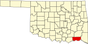 | |
| Towns | ||
| CDPs | ||
| Other unincorporated communities | ||
| Indian reservation | ||
| Footnotes | ‡This populated place also has portions in another county or counties | |
| International | |
|---|---|
| National | |