Sylt-Ost
This article needs additional citations for verification. (April 2015) |
Sylt-Ost | |
|---|---|
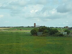
 St. Severin in Keitum | |
| Coordinates: 54°52′N 08°22′E / 54.867°N 8.367°E | |
| Country | Germany |
| State | Schleswig-Holstein |
| District | Nordfriesland |
| Disbanded | 1 January 2009 |
| Area | |
• Total | 37.97 km2 (14.66 sq mi) |
| Elevation | 1 m (3 ft) |
| Population (2007-12-31) | |
• Total | 5,833 |
| • Density | 150/km2 (400/sq mi) |
| Time zone | UTC+01:00 (CET) |
| • Summer (DST) | UTC+02:00 (CEST) |
| Postal codes | 25980 |
| Dialling codes | 04651 |
| Vehicle registration | NF |
| Website | www.gemeinde-sylt.de |
Sylt-Ost (translated, East Sylt) is a former municipality on the island of Sylt, in the district of Nordfriesland, in Schleswig-Holstein, Germany. It used to be the administrative seat of the Amt Landschaft Sylt and a municipality into which a number of villages had been amalgamated in 1970. However, following a referendum in May 2008, Sylt-Ost merged with Westerland and Rantum to form the collective municipality Gemeinde Sylt which was created on 1 January 2009. Since 2009, the seat of the Amt Landschaft Sylt has been in Westerland.[1]
Subdivision
The former municipality "Sylt-Ost" was created from five villages in 1970:
- Archsum
- Keitum
- Morsum
- Munkmarsch (previously an Ortsteil of Keitum)
- Tinnum
The five villages are now Ortsteile of Gemeinde Sylt.
Politics
Mayors
- 1986-1996: Heinz Maurus, CDU
- 1996-2005: Ingbert Liebing, CDU
- 2005-2008: Christoph Schmatloch, CDU
- 2008: Erik Kennel
Arms
Blazon: Per fess low or and azure. Above a sun rising in his splendour gules, accompanied by five eight-pointed mullets azure. Below a herring argent swimming to the left.[2]
The coat of arms was designed by a Sylt artist and granted in 2002. The five mullets (stars) in it symbolise the villages of the municipality. The herring is meant to depict the former importance of fishery for the area, it was already used as the seal of the Sylt bailiffs in the 17th century. The colours are the traditional North Frisian colours which are also reflected in the island's national costume.
Economy
The most important factor of income in the area is tourism, which nowadays completely dominates the Sylt economy. Having been the most important sector prior to the arrival of the tourist business, agriculture today plays a minor role.
References
- ^ "Westerland und Sylt-Ost fusionieren" (in German). Schleswig-Holsteinischer Zeitungsverlag. Archived from the original on 2012-09-19.
- ^ Schleswig-Holstein Municipal Roll of Arms[permanent dead link] (in German)


