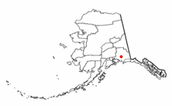
Tonsina, Alaska
Tonsina, Alaska | |
|---|---|
 Location of Tonsina, Alaska | |
| Country | United States |
| State | Alaska |
| Census Area | Valdez-Cordova |
| Area | |
| • Total | 148.0 sq mi (383.3 km2) |
| • Land | 147.8 sq mi (382.8 km2) |
| • Water | 0.2 sq mi (0.5 km2) |
| Elevation | 1,565 ft (477 m) |
| Population (2000) | |
| • Total | 92 |
| • Density | 0.6/sq mi (0.2/km2) |
| Time zone | UTC-9 (Alaska (AKST)) |
| • Summer (DST) | UTC-8 (AKDT) |
| Area code | 907 |
| FIPS code | 02-78350 |
| GNIS feature ID | 1411105 |
Tonsina (/[invalid input: 'icon']tɒnˈsiːnə/) is a census-designated place (CDP) in Valdez-Cordova Census Area, Alaska, United States At the 2000 census the population was 92.
Tonsina is part of the Copper River Valley area. The centerpiece of Tonsina valley is the Tonsina River Lodge. This roadhouse alongside the Richardson Highway consists of a bar, restaurant, gas station, convenience and liquor store, laundromat and showers. There is also a camping area, RV park and motel. A main attraction of the roadhouse is the historic hotel.
The Tonsina River Lodge is a rambling, shambling, gravel-covered spread, with weatherbeaten buildings. The historic hotel is an orange, three story Army barracks with a red tin roof. It once was a brothel. The lodge is at the end of an airplane runway. The lodge sits in the foothills of several towering, snow-capped mountain ranges, next to a stream. In 2006, the flooding from the stream took out the two-lane concrete bridge that crosses the stream. Connecting Valdez to Anchorage, the Richardson Highway bridge was repaired in two weeks.
Geography
Tonsina is located at 61°39′43″N 145°10′39″W / 61.66194°N 145.17750°WInvalid arguments have been passed to the {{#coordinates:}} function (61.661883, -145.177582)Template:GR.
According to the United States Census Bureau, the CDP has a total area of 148.0 square miles (383.3 km²), of which, 147.8 square miles (382.8 km²) of it is land and 0.2 square miles (0.5 km²) of it (0.13%) is water.
Demographics
As of the censusTemplate:GR of 2000, there were 92 people, 34 households, and 21 families residing in the CDP. The population density was 0.6 people per square mile (0.2/km²). There were 45 housing units at an average density of 0.3/sq mi (0.1/km²). The racial makeup of the CDP was 84.78% White, 2.17% Black or African American, 9.78% Native American and 3.26% Asian.
There were 34 households out of which 35.3% had children under the age of 18 living with them, 55.9% were married couples living together, 2.9% had a female householder with no husband present, and 35.3% were non-families. 26.5% of all households were made up of individuals and 5.9% had someone living alone who was 65 years of age or older. The average household size was 2.71 and the average family size was 3.45.
In the CDP the age distribution of the population shows 32.6% under the age of 18, 4.3% from 18 to 24, 17.4% from 25 to 44, 28.3% from 45 to 64, and 17.4% who were 65 years of age or older. The median age was 42 years. For every 100 females there were 142.1 males. For every 100 females age 18 and over, there were 121.4 males.
The median income for a household in the CDP was $32,188, and the median income for a family was $48,750. Males had a median income of $58,000 versus $25,000 for females. The per capita income for the CDP was $13,390. There were 7.4% of families and 6.7% of the population living below the poverty line, including no under eighteens and none of those over 64.
