Tracy Glacier (Antarctica)
| Tracy Glacier | |
|---|---|
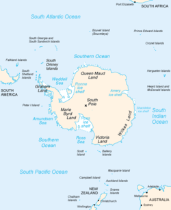
 Map of Antarctica, with Wilkes Land slightly to the right | |
Location of Tracy Glacier in Antarctica | |
| Type | channel |
| Location | Wilkes Land |
| Coordinates | 65°57′00″S 102°20′00″E / 65.95000°S 102.33333°E |
| Thickness | unknown |
| Terminus | Shackleton Ice Shelf |
| Status | unknown |
Tracy Glacier (65°57′S 102°20′E / 65.950°S 102.333°E) is a channel glacier flowing to the Shackleton Ice Shelf 4 nautical miles (7 km) southwest of Cape Elliott. Delineated from aerial photographs taken by U.S. Navy Operation Highjump, 1946–47. Named by Advisory Committee on Antarctic Names (US-ACAN) for Lieutenant Lloyd W. Tracy, U.S. Navy, pilot with U.S. Navy Operation Windmill, 1947–48, who assisted in operations which resulted in the establishment of astronomical control stations from Wilhelm II Coast to Budd Coast.
See also[edit]
![]() This article incorporates public domain material from "Tracy Glacier (Antarctica)". Geographic Names Information System. United States Geological Survey.
This article incorporates public domain material from "Tracy Glacier (Antarctica)". Geographic Names Information System. United States Geological Survey.

