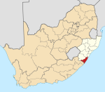
Trafalgar, South Africa
Appearance
Trafalgar | |
|---|---|
 Trafalgar Beach | |
| Coordinates: 30°57′29″S 30°17′31″E / 30.958°S 30.292°E | |
| Country | South Africa |
| Province | KwaZulu-Natal |
| District | Ugu |
| Municipality | Ray Nkonyeni |
| Main Place | Southbroom |
| Area | |
• Total | 2.63 km2 (1.02 sq mi) |
| Population (2011)[1] | |
• Total | 397 |
| • Density | 150/km2 (390/sq mi) |
| Racial makeup (2011) | |
| • Black African | 21.4% |
| • Coloured | 0.5% |
| • White | 78.1% |
| First languages (2011) | |
| • English | 50.6% |
| • Afrikaans | 35.3% |
| • Zulu | 6.5% |
| • Xhosa | 3.5% |
| • Other | 4.0% |
| Time zone | UTC+2 (SAST) |
| PO box | 4275 |
Trafalgar is a seaside resort village in Ugu District Municipality in the KwaZulu-Natal province of South Africa. Trafalgar is on the north bank of the Mpenjati river which enters the Indian Ocean at the Mpenjati Nature Reserve. The beach at Mpenjati Nature Reserve has been used by naturists for many years.
References
- ^ a b c d "Sub Place Trafalgar". Census 2011.


