Jump to content

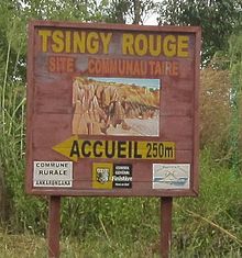
Tsingy Rouge

Coordinates: 12°38′20″S 49°29′50″E / 12.63889°S 49.49722°E / -12.63889; 49.49722
From Wikipedia, the free encyclopedia

This is an old revision of this page, as edited by Irn (talk | contribs) at 14:02, 5 February 2018 (Reverted 1 edit by 86.90.173.149 (talk): Per WP:ELNO. (TW)). The present address (URL) is a permanent link to this revision, which may differ significantly from the current revision.

Tsingy Rouge-Ankarangona

The Tsingy Rouge (Red Tsingy) is a stone formation of red laterite formed by erosion[1] of the Irodo River in the region of Diana in northern Madagascar.

It is situated approximately 60 km south of Antsiranana near the town of Sadjoavato.

References and notes

12°38′20″S 49°29′50″E / 12.63889°S 49.49722°E / -12.63889; 49.49722