Jump to content

Tunsbergdalsbreen

Coordinates: 61°35′N 7°07′E / 61.583°N 7.117°E / 61.583; 7.117
From Wikipedia, the free encyclopedia

This is the current revision of this page, as edited by Jay1279 (talk | contribs) at 21:25, 20 January 2020 (References: update category after county merger). The present address (URL) is a permanent link to this version.

(diff) ← Previous revision | Latest revision (diff) | Newer revision → (diff)
Tunsbergdalsbreen
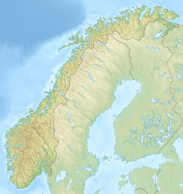
Map showing the location of Tunsbergdalsbreen
Location of the glacier
Map showing the location of Tunsbergdalsbreen
Tunsbergdalsbreen (Norway)
LocationVestland, Norway
Coordinates61°35′N 7°07′E / 61.583°N 7.117°E / 61.583; 7.117

Tunsbergdalsbreen is a glacier in the municipality of Luster in Vestland, Norway. It is a side branch of the Jostedalsbreen glacier, and is included in the Jostedalsbreen National Park.[1]

See also

[edit]

References

[edit]
  1. ^ Lauritzen, Per Roger, ed. (2009). "Tunsbergdalsbreen". Norsk Fjelleksikon (in Norwegian). Arendal: Friluftsforlaget. ISBN 978-82-91-49547-7.