
Wittenbeck
You can help expand this article with text translated from the corresponding article in German. (July 2016) Click [show] for important translation instructions.
|
Wittenbeck | |
|---|---|
 Coat of arms | |
Location of Wittenbeck within Rostock district  | |
 Wittenbeck  Wittenbeck | |
| Coordinates: 54°6′N 11°46′E / 54.100°N 11.767°E | |
| Country | Germany |
| State | Mecklenburg-Vorpommern |
| District | Rostock |
| Municipal assoc. | Bad Doberan-Land |
| Government | |
| • Mayor | Annette Fink |
| Area | |
| • Total | 9.93 km2 (3.83 sq mi) |
| Elevation | 43 m (141 ft) |
| Population (2022-12-31)[1] | |
| • Total | 899 |
| • Density | 91/km2 (230/sq mi) |
| Time zone | UTC+01:00 (CET) |
| • Summer (DST) | UTC+02:00 (CEST) |
| Postal codes | 18209 |
| Dialling codes | 038293 |
| Vehicle registration | LRO |
| Website | www.doberan-land.de |
Wittenbeck is a municipality in the Rostock district, in Mecklenburg-Vorpommern, Germany.
Gallery
-
-
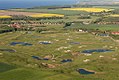
 Pasture in Wittenbeck


References
- ^ "Bevölkerungsstand der Kreise, Ämter und Gemeinden 2022" (XLS) (in German). Statistisches Amt Mecklenburg-Vorpommern. 2023.
External links
 Media related to Wittenbeck at Wikimedia Commons
- wittenbeck.com - Official website of the municipality (German)
| International | |
|---|---|
| National | |
This Rostock district location article is a stub. You can help Wikipedia by expanding it. |