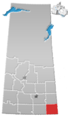
Woodley, Saskatchewan
This article's tone or style may not reflect the encyclopedic tone used on Wikipedia. (June 2016) |
Woodley, Saskatchewan | |
|---|---|
| Coordinates: 49°15′00″N 102°32′24″W / 49.250°N 102.540°W | |
| Country | Canada |
| Province | Saskatchewan |
| Region | Southeast Saskatchewan |
| Census division | 1 |
| Rural Municipality | Benson |
| Government | |
| • Reeve | David Hoffort |
| • Administrator | Laureen Keating |
| • Governing body | Benson No. 35 |
| Area | |
| • Total | 0.00 km2 (0.00 sq mi) |
| Elevation | 593 m (1,947 ft) |
| Population (2011) | |
| • Total | 0 |
| • Density | 0.0/km2 (0/sq mi) |
| Time zone | CST |
| Area code | 306 |
| [1][2][3][4] | |
Woodley is an unincorporated community in Benson Rural Municipality No. 35, Saskatchewan, Canada.
Demographics
Woodley, like so many other small communities throughout Saskatchewan, has struggled to maintain a sturdy population causing it to become a semi ghost town. Although numbers dwindling, it has had a spike(with renewed oil exploration)in recent influx. It is now the snowmobile capital of The world, and may be the toy capital of the world with sleds equalling more than the population as well as motor cycles, quads, and side-by-sides. This community flourishes with a younger generation giving it unique limited growth to a select few special families. This community is unique to its surroundings never boasting but hiding the famous visitors that randomly appear in the area. Let alone the individuals that occupy its town. Disclosed but accessible, this is one of the few communities that with its extensive ties to the higher hierarchy, never gives its secrets away.
Heritage sites
- St Luke's Lutheran church built in 1929 by Emil Kraus.
See also
References
- ^ National Archives, Archivia Net, Post Offices and Postmasters
- ^ Government of Saskatchewan, MRD Home, Municipal Directory System, archived from the original on November 21, 2008
- ^ Canadian Textiles Institute. (2005), CTI Determine your provincial constituency
- ^ Commissioner of Canada Elections, Chief Electoral Officer of Canada (2005), Elections Canada On-line
49°15′00″N 102°32′24″W / 49.250°N 102.540°W


