Žebrák Castle
| Žebrák Castle | |
|---|---|
 The Žebrák Castle with Točník behind it | |
| General information | |
| Type | Medieval castle |
| Location | Central Bohemian Region, Czech Republic |
| Country | Czech Republic |
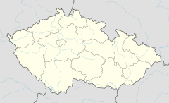
Žebrák Castle lies in the Central Bohemian Region of the Czech Republic. More accurately, it is in the Beroun District above the village of Točník and 2 kilometres (1.2 mi) from the village of Žebrák. It was built by the Zajíc family. The two castles, Točník and Žebrák, make up a picturesque "couple," standing almost right next to each other.
History
The castle was built in the second half of the 13th century by Oldřich Zajíc III, but the Zajíc family soon moved elsewhere and sold the castle to the king. In 1336, the house of Luxembourg acquired Žebrák and in 1346, Jindřich of the Luxembourg house started renovating it.[1] He later gave the castle to Karel IV, who became the Holy Roman Emperor shortly afterwards. Karel's son Václav IV liked the castle very much, but after the large fire in 1395, he built a more strategically positioned castle above it. During the Hussite wars, the Hussite army unsuccessfully besieged Žebrák and Točník and then proceeded to burn down the towns Točník and Hořovice. In 1532, another fire struck the castle, but this time, nobody bothered renovating it. In the year 1923, the castle was sold to the Czech Association of Tourists for 8000 crowns and now it belongs to the state.[2]
References
- ^ "Dějiny hradu Žebráka". describes history. tocnik-zebrak. Retrieved 1 April 2012.
- ^ "Historie". Historical events. tocnik. Retrieved 1 April 2012.

