
Portal:Myanmar
ကြိုဆိုပါတယ်။ / Welcome to the Myanmar Portal 

Myanmar, officially the Republic of the Union of Myanmar and also known as Burma (the official name until 1989), is a country in Southeast Asia. It is the largest country by area in Mainland Southeast Asia and has a population of about 55 million. It is bordered by Bangladesh and India to its northwest, China to its northeast, Laos and Thailand to its east and southeast, and the Andaman Sea and the Bay of Bengal to its south and southwest. The country's capital city is Naypyidaw, and its largest city is Yangon (formerly Rangoon).
Myanmar is a member of the East Asia Summit, Non-Aligned Movement, ASEAN, and BIMSTEC, but it is not a member of the Commonwealth of Nations despite once being part of the British Empire. Myanmar is a Dialogue Partner of the Shanghai Cooperation Organization. The country is very rich in natural resources, such as jade, gems, oil, natural gas, teak and other minerals, as well as also endowed with renewable energy, having the highest solar power potential compared to other countries of the Great Mekong Subregion. However, Myanmar has long suffered from instability, factional violence, corruption, poor infrastructure, as well as a long history of colonial exploitation with little regard to human development. In 2013, its GDP (nominal) stood at US$56.7 billion and its GDP (PPP) at US$221.5 billion. The income gap in Myanmar is among the widest in the world, as a large proportion of the economy is controlled by cronies of the military junta. Myanmar is one of the least developed countries; as of 2020, according to the Human Development Index, it ranks 147 out of 189 countries in terms of human development, the lowest in Southeast Asia. Since 2021, more than 600,000 people were displaced across Myanmar due to the surge in violence post-coup, with more than 3 million people in dire need of humanitarian assistance. (Full article...)
Selected articles -
-
![Image 1 The State Peace and Development Council (Burmese: နိုင်ငံတော် အေးချမ်းသာယာရေး နှင့် ဖွံ့ဖြိုးရေး ကောင်စီ [nàɪɰ̃ŋàɰ̃dɔ̀ ʔédʑáɰ̃θàjajé n̥ḭɰ̃ pʰʊ̰ɰ̃bjó jé kaʊ̀ɰ̃sì]; abbreviated SPDC or နအဖ, [na̰ʔa̰pʰa̰]) was the official name of the military government of Burma (Myanmar) which, in 1997, succeeded the State Law and Order Restoration Council (Burmese: နိုင်ငံတော် ငြိမ်ဝပ်ပိပြားမှု တည်ဆောက်ရေးအဖွဲ့; abbreviated SLORC or နဝတ) that had seized power under the rule of Saw Maung in 1988. On 30 March 2011, Senior General and Council Chairman Than Shwe signed a decree that officially dissolved the council. SLORC succeeded the Pyithu Hluttaw as a legislature and the Council of State as a ruling council, after dissolving the state organs of the Socialist Republic of the Union of Burma. In 1997, SLORC was abolished and reconstituted as the State Peace and Development Council (SPDC). The powerful regional military commanders, who were members of SLORC, were promoted to new positions and transferred to the capital of Rangoon (now Yangon). The new regional military commanders were not included in the membership of the SPDC. (Full article...)](//upload.wikimedia.org/wikipedia/en/d/d2/Blank.png)

The State Peace and Development Council (Burmese: နိုင်ငံတော် အေးချမ်းသာယာရေး နှင့် ဖွံ့ဖြိုးရေး ကောင်စီ [nàɪɰ̃ŋàɰ̃dɔ̀ ʔédʑáɰ̃θàjajé n̥ḭɰ̃ pʰʊ̰ɰ̃bjó jé kaʊ̀ɰ̃sì]; abbreviated SPDC or နအဖ, [na̰ʔa̰pʰa̰]) was the official name of the military government of Burma (Myanmar) which, in 1997, succeeded the State Law and Order Restoration Council (Burmese: နိုင်ငံတော် ငြိမ်ဝပ်ပိပြားမှု တည်ဆောက်ရေးအဖွဲ့; abbreviated SLORC or နဝတ) that had seized power under the rule of Saw Maung in 1988. On 30 March 2011, Senior General and Council Chairman Than Shwe signed a decree that officially dissolved the council.
SLORC succeeded the Pyithu Hluttaw as a legislature and the Council of State as a ruling council, after dissolving the state organs of the Socialist Republic of the Union of Burma. In 1997, SLORC was abolished and reconstituted as the State Peace and Development Council (SPDC). The powerful regional military commanders, who were members of SLORC, were promoted to new positions and transferred to the capital of Rangoon (now Yangon). The new regional military commanders were not included in the membership of the SPDC. (Full article...) -
The Andaman Sea (historically also known as the Burma Sea) is a marginal sea of the northeastern Indian Ocean bounded by the coastlines of Myanmar and Thailand along the Gulf of Martaban and the west side of the Malay Peninsula, and separated from the Bay of Bengal to its west by the Andaman Islands and the Nicobar Islands. Its southern end is at Breueh Island just north of Sumatra, with the Strait of Malacca further southeast.
Traditionally, the sea has been used for fishery and transportation of goods between the coastal countries and its coral reefs and islands are popular tourist destinations. The fishery and tourist infrastructure was severely damaged by the December 2004 Indian Ocean earthquake and tsunami. (Full article...) -
Portia labiata is a jumping spider (family Salticidae) found in Sri Lanka, India, southern China, Burma (Myanmar), Malaysia, Singapore, Java, Sumatra and the Philippines. In this medium-sized jumping spider, the front part is orange-brown and the back part is brownish. The conspicuous main eyes provide vision more acute than a cat's during the day and 10 times more acute than a dragonfly's, and this is essential in P. labiata′s navigation, hunting and mating.
The genus Portia has been called "eight-legged cats", as their hunting tactics are as versatile and adaptable as a lion's. All members of Portia have instinctive hunting tactics for their most common prey, but often can improvise by trial and error against unfamiliar prey or in unfamiliar situations, and then remember the new approach. While most jumping spiders prey mainly on insects and by active hunting, females of Portia also build webs to catch prey directly and sometimes join their own webs on to those of web-based spiders. Both females and males prefer web spiders as prey, followed by other jumping spiders, and finally insects. In all cases females are more effective predators than males. (Full article...) -
Zigrasimecia is an extinct genus of ants which existed in the Cretaceous period approximately 98 million years ago. The first specimens were collected from Burmese amber in Kachin State, 100 kilometres (62 mi) west of Myitkyina town in Myanmar. In 2013, palaeoentomologists Phillip Barden and David Grimaldi published a paper describing and naming Zigrasimecia tonsora. They described a dealate female with unusual features, notably the highly specialized mandibles. Other features include large ocelli, short scapes, 12 antennomeres, small eyes, and a clypeal margin that has a row of peg-like denticles. The genus Zigrasimecia was originally incertae sedis (uncertain placement) within Formicidae until a second species, Zigrasimecia ferox, was described in 2014, leading to its placement in the subfamily Sphecomyrminae. Later, it was considered to belong to the distinct subfamily Zigrasimeciinae.
Due to the highly specialized mandibles, scientists believe that the ants exhibited habits no longer seen in extant ants. The highly movable head suggests that mobility was an important factor for them (probably for feeding behavior), and the rugose projections may have played a major role in nest excavation because the mandibles would have prevented such activity. Zigrasimecia most likely interacted with the extinct ant genus Gerontoformica through conflict and probably shared some of their ecological niches. The mandibles of these ants were probably used for mechanical interactions with food, and they may also have served as traps for potential arthropod prey such as mites and small flies. Zigrasimecia was possibly a generalist predator. (Full article...) -

Portrait of the Thirty Comrades
The Thirty Comrades (Burmese: ရဲဘော်သုံးကျိပ်) constituted the embryo of the modern Burmese army called the Burma Independence Army (BIA) which was formed to fight for independence from Britain. This was accomplished just before the majority of the Thirty Comrades returned with the invading Japanese Army initially through Southern Burma in December 1941.
In April 1941, small groups of Burmese youth left Burma secretly to obtain military training to fight the British colonists in the struggle for independence. Their leader was Thakin Aung San and they were sent by the Dobama Asiayone ("We Burmans Association") with the intention to get assistance from Guangzhou. By a quirk of fate, however, they ran into the Japanese instead in Amoy and arrived in Japan later to be flown to occupied parts of Sanya, in order to receive military training from the Japanese Army. They were later moved to Formosa for security reasons and subsequently returned to Burma via Vietnam and
Thailand with the Japanese. On 26 December 1941, in a house (owned by a Burmese doctor) in Bangkok, about 25 of the Thirty Comrades had their blood drawn from their arms in syringes, then poured into a silver bowl from which each of them drank – thway thauk in time-honoured Burmese military tradition – pledging "eternal loyalty" among themselves and to the cause of Burmese independence. Their average age was just 24 years. A Japanese officer called Suzuki Keiji, better known among the Burmese by his nom de guerre Bo Mogyo (Commander Thunderbolt) and head of a special intelligence unit called Minami Kikan (南機関) formed in order to support a national uprising in Burma, was the mentor and principal trainer of the Thirty Comrades. The British were driven out of Burma to India during World War II. (Full article...) -
General elections were held in Myanmar on 8 November 2015, with the National League for Democracy winning a supermajority of seats in the combined national parliament. Voting occurred in all constituencies, excluding seats appointed by the military, to select Members of Assembly to seats in both the upper house (the House of Nationalities) and the lower house (the House of Representatives) of the Assembly of the Union, and State and Region Hluttaws. Ethnic Affairs Ministers were also elected by their designated electorates on the same day, although only select ethnic minorities in particular states and regions were entitled to vote for them.
These polls were the first openly contested election held in the country since 1990, which was annulled by the military government after the National League for Democracy's (NLD) victory. The poll was preceded by the 2010 general election, which was marred by a boycott and widespread allegations of systematic fraud by the victorious Union Solidarity and Development Party (USDP). (Full article...) -
The Salween is a Southeast Asian river, about 3,289 kilometres (2,044 mi) long, flowing from the Tibetan Plateau south into the Andaman Sea. The Salween flows primarily within southwest China and eastern Myanmar (Burma), with a short section forming the border of Burma and Thailand. Throughout most of its course, it runs swiftly through rugged mountain canyons. Despite the river's great length, only the last 90 km (56 mi) are navigable, where it forms a modest estuary and delta at Mawlamyine. The river is known by various names along its course, including the Thanlwin (named after Elaeocarpus sp., an olive-like plant that grows on its banks) in Burma and the Nu Jiang (or Nu River, named after Nu people) in China. The commonly used spelling "Salween" is an anglicisation of the Burmese name dating from 19th-century British maps.
Due to its great range of elevation and latitude coupled with geographic isolation, the Salween basin is considered one of the most ecologically diverse regions in the world, containing an estimated 25 percent of the world's terrestrial animal species and thousands of plant species. Along its course the Salween provides water for agriculture and supports abundant fisheries, especially in the delta region. The Salween basin is home to numerous ethnic minority groups, whose ancestors largely originated in the Tibetan Plateau and northwest China. Starting about 5,000 years ago, people began migrating south along the river, establishing small kingdoms and city-states. (Full article...) -

Bawbawgyi Pagoda is one of the earliest existing examples of a Burmese pagoda.
Burmese pagodas are stupas that typically house Buddhist relics, including relics associated with Buddha. Pagodas feature prominently in Myanmar's landscape, earning the country the moniker "land of pagodas." According to 2016 statistics compiled by the State Sangha Maha Nayaka Committee, Myanmar is home to 1,479 pagodas exceeding 27 feet (8.2 m) in height, a quarter of which are located in Sagaing Region. Several cities in the country, including Mandalay and Bagan, are known for their abundance of pagodas. Pagodas are the site of seasonal pagoda festivals.
Burmese pagodas are enclosed in a compound known as the aran (အာရာမ်, from Pali ārāma), with gateways called mok (မုခ်, from Pali mukha) at the four cardinal directions. The platform surrounding a Burmese pagoda is called a yinbyin (ရင်ပြင်). (Full article...) -
There is a history of persecution of Muslims in Myanmar that continues to the present day. Myanmar is a Buddhist majority country, with significant Christian and Muslim minorities. While Muslims served in the government of Prime Minister U Nu (1948–63), the situation changed with the 1962 Burmese coup d'état. While a few continued to serve, most Christians and Muslims were excluded from positions in the government and army. In 1982, the government introduced regulations that denied citizenship to anyone who could not prove Burmese ancestry from before 1823. This disenfranchised many Muslims in Myanmar, even though they had lived in Myanmar for several generations.
The Rohingya people are a large Muslim group in Myanmar; the Rohingyas have been among the most persecuted group under Myanmar's military regime, with the Kachin, who are predominantly U.S. Baptists, a close second. The UN states that the Rohingyas are one of the most persecuted groups in the world. Since 1948, successive governments have carried out 13 military operations against the Rohingya (including in 1975, 1978, 1989, 1991–92, 2002). During the operations, Myanmar security forces have driven the Rohingyas off their land, burned down their mosques and committed widespread looting, arson and rape of Rohingya Muslims. Outside of these military raids, Rohingya are subjected to frequent theft and extortion from the authorities and many are subjected to forced labor. In some cases, land occupied by Rohingya Muslims has been confiscated and reallocated to local Buddhists. (Full article...) -
Naypyidaw, officially romanized Nay Pyi Taw (Burmese: နေပြည်တော်; MLCTS: Nepranytau; pronounced [nèpjìdɔ̀] lit. 'Grand Capital'), is the capital and third-largest city of Myanmar. The city is located at the centre of the Naypyidaw Union Territory. It is unusual among Myanmar's cities in that it is an entirely planned city outside of any state or region. The city, then known only as Pyinmana District, officially replaced Yangon as the administrative capital of Myanmar on 6 November 2005; its official name was revealed to the public on Armed Forces Day, 27 March 2006.
As the seat of the government of Myanmar, Naypyidaw is the site of the Union Parliament, the Supreme Court, the Presidential Palace, the official residences of the Cabinet of Myanmar and the headquarters of government ministries and military. Naypyidaw is notable for its unusual combination of large size and very low population density. The city hosted the 24th and 25th ASEAN Summit, the 3rd BIMSTEC Summit, the Ninth East Asia Summit, the 2013 Southeast Asian Games and the 2014 AFC U-19 Championship. (Full article...)
![Image 1 The State Peace and Development Council (Burmese: နိုင်ငံတော် အေးချမ်းသာယာရေး နှင့် ဖွံ့ဖြိုးရေး ကောင်စီ [nàɪɰ̃ŋàɰ̃dɔ̀ ʔédʑáɰ̃θàjajé n̥ḭɰ̃ pʰʊ̰ɰ̃bjó jé kaʊ̀ɰ̃sì]; abbreviated SPDC or နအဖ, [na̰ʔa̰pʰa̰]) was the official name of the military government of Burma (Myanmar) which, in 1997, succeeded the State Law and Order Restoration Council (Burmese: နိုင်ငံတော် ငြိမ်ဝပ်ပိပြားမှု တည်ဆောက်ရေးအဖွဲ့; abbreviated SLORC or နဝတ) that had seized power under the rule of Saw Maung in 1988. On 30 March 2011, Senior General and Council Chairman Than Shwe signed a decree that officially dissolved the council. SLORC succeeded the Pyithu Hluttaw as a legislature and the Council of State as a ruling council, after dissolving the state organs of the Socialist Republic of the Union of Burma. In 1997, SLORC was abolished and reconstituted as the State Peace and Development Council (SPDC). The powerful regional military commanders, who were members of SLORC, were promoted to new positions and transferred to the capital of Rangoon (now Yangon). The new regional military commanders were not included in the membership of the SPDC. (Full article...)](/wiki/File:Blank.png)
.svg)


Did you know (auto-generated) -

- ... that Maung O, Prince of Salin, and his sister Nanmadaw Me Nu became de facto rulers of Burma when King Bagyidaw was suffering from depression?
- ... that Rolling Stone named Mission of Burma's "Academy Fight Song" as one of the 100 greatest debut singles of all time?
- ... that as part of the coronation of Mindon Min, the square yuzana around the capital was designated a sanctuary?
- ... that the Myanmar Coast Guard was initially proposed as a civilian law enforcement agency before being established as a branch of the military three years later?
- ... that the Burmese and South Korean first ladies held their first informal conversation 44 years after the establishment of bilateral relations between the two countries?
- ... that former Burmese actress Honey Nway Oo turned rebel and took up arms against the military junta following the 2021 Myanmar coup d'état?
- ... that Molly Burman resumed releasing music three years later after finding that "Happy Things" had accrued a million streams on Spotify?
- ... that Aung Myo Min, Union Minister of Human Rights for the National Unity Government of Myanmar, is the country's first openly LGBT minister?
Related portals and projects
General images -
-
 Protesters in Yangon carrying signs reading "Free Daw Aung San Suu Kyi" on 8 February 2021. (from History of Myanmar)
 -
 Saint Mary's Cathedral in Downtown Yangon is the largest Roman Catholic cathedral in Burma. (from Culture of Myanmar)
 -
 Former US President Barack Obama poses barefoot on the grounds of Shwedagon Pagoda, one of Myanmar's major Buddhist pilgrimage sites. (from Culture of Myanmar)
 -
 A theatrical performance of the Mon dance (from Culture of Myanmar)
 -
 Two female musicians play the saung at a performance in Mandalay. (from Culture of Myanmar)
 -
 Aerial view of a burned Rohingya village in Rakhine state, Myanmar, September 2017 (from History of Myanmar)
 -
 A wide range of Burmese lacquerware from Bagan (from Culture of Myanmar)
 -
 A group of Buddhist worshipers at Shwedagon Pagoda, an important religious site for Burmese Buddhists (from Culture of Myanmar)
 -
 British soldiers dismantling cannons belonging to King Thibaw's forces, Third Anglo-Burmese War, Ava, 27 November 1885. Photographer: Hooper, Willoughby Wallace (1837–1912). (from History of Myanmar)
 -
 British soldiers on patrol in the ruins of the Burmese town of Bahe during the advance on Mandalay, January 1945. (from History of Myanmar)
 -
 The shores of Irrawaddy River at Nyaung-U, Bagan (from Geography of Myanmar)
 -

-
 A wedding procession, with the groom and bride dressed in traditional Burmese wedding clothes, reminiscent of royal attire (from Culture of Myanmar)
 -
 British soldiers remove their shoes at the entrance of Shwedagon Pagoda. To the left, a sign reads "Foot wearing is strictly prohibited" in Burmese, English, Tamil, and Urdu. (from Culture of Myanmar)
 -
 A large fracture on the Mingun Pahtodawgyi caused by the 1839 Ava earthquake. (from Geography of Myanmar)
 -
 Vegetable stall on the roadside at the Madras Lancer Lines, Mandalay, January 1886. Photographer: Hooper, Willoughby Wallace (1837–1912). (from History of Myanmar)
 -
 Grandfather Island, Dawei (from Geography of Myanmar)
 -
 Temples at Mrauk U, was the capital of the Mrauk U Kingdom, which ruled over what is now Rakhine State. (from History of Myanmar)
 -
 The restored Taungoo or Nyaungyan dynasty c. 1650 CE. (from History of Myanmar)
 -
 A bull fight, 19th-century watercolour (from Culture of Myanmar)
 -
 Salween river at Mae Sam Laep on the Thai-Myanmar border (from Geography of Myanmar)
 -
 Sculpture of Myanmar mythical lion (from Culture of Myanmar)
 -

-
 Mount Popa, a dormant volcano in the Central Lowlands (from Geography of Myanmar)
 -
 Pagan Kingdom during Narapatisithu's reign. Burmese chronicles also claim Kengtung and Chiang Mai. Core areas shown in darker yellow. Peripheral areas in light yellow. Pagan incorporated key ports of Lower Burma into its core administration by the 13th century. (from History of Myanmar)
 -
 Boxing match, 19th-century watercolour (from Culture of Myanmar)
 -

-
 Mountains near Pindaya on the Shan Plateau (from Geography of Myanmar)
 -
 Recorder's Court on Sule Pagoda Road, with the Sule Pagoda at the far end, Rangoon, 1868. Photographer: J. Jackson. (from History of Myanmar)
 -
 Portuguese ruler and soldiers mounting an Elephant. Philips, Jan Caspar (draughtsman and engraver) (from History of Myanmar)
 -
 The paddle steamer Ramapoora (right) of the British India Steam Navigation Company on the Rangoon river having just arrived from Moulmein. 1895. Photographers: Watts and Skeen (from History of Myanmar)
 -
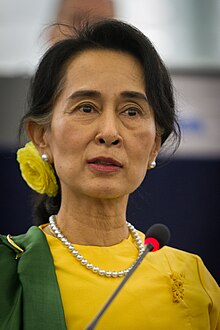
 Aung San Suu Kyi addresses crowds at the NLD headquarters shortly after her release. (from History of Myanmar)
 -
 Protesters in Yangon with a banner that reads non-violence: national movement in Burmese, in the background is Shwedagon Pagoda. (from History of Myanmar)
 -
 Myanmar (Burma) map of Köppen climate classification (from Geography of Myanmar)
 -
 19th-century funeral cart and spire, which would form part of the procession from the home to the place of cremation (from Culture of Myanmar)
 -
 Myinhkin thabin - equestrian sport (from Culture of Myanmar)
 -
 Political Map of Burma (Myanmar) c. 1450 CE. (from History of Myanmar)
 -

-
 Hlei pyaingbwè - a Burmese regatta (from Culture of Myanmar)
 -
 Jade Mine in Hpakant (from Geography of Myanmar)


_headquarter.jpg)


Major topics
Categories

More topics

Associated Wikimedia
The following Wikimedia Foundation sister projects provide more on this subject:
-
 Commons
Free media repository -
 Wikibooks
Free textbooks and manuals -
 Wikidata
Free knowledge base -
 Wikinews
Free-content news -
 Wikiquote
Collection of quotations -
 Wikisource
Free-content library -
 Wikiversity
Free learning tools -
 Wikivoyage
Free travel guide -
 Wiktionary
Dictionary and thesaurus


