
Portal:World
The World Portal


The world is the totality of entities, the whole of reality, or everything that exists. The nature of the world has been conceptualized differently in different fields. Some conceptions see the world as unique while others talk of a "plurality of worlds". Some treat the world as one simple object while others analyze the world as a complex made up of parts.
In scientific cosmology, the world or universe is commonly defined as "[t]he totality of all space and time; all that is, has been, and will be". Theories of modality talk of possible worlds as complete and consistent ways how things could have been. Phenomenology, starting from the horizon of co-given objects present in the periphery of every experience, defines the world as the biggest horizon or the "horizon of all horizons". In philosophy of mind, the world is contrasted with the mind as that which is represented by the mind. Theology conceptualizes the world in relation to God, for example, as God's creation, as identical to God or as the two being interdependent. In religions, there is a tendency to downgrade the material or sensory world in favor of a spiritual world to be sought through religious practice. A comprehensive representation of the world and our place in it, as is found in religions, is known as a worldview. Cosmogony is the field that studies the origin or creation of the world while eschatology refers to the science or doctrine of the last things or of the end of the world.
In various contexts, the term "world" takes a more restricted meaning associated, for example, with the Earth and all life on it, with humanity as a whole or with an international or intercontinental scope. In this sense, world history refers to the history of humanity as a whole and world politics is the discipline of political science studying issues that transcend nations and continents. Other examples include terms such as "world religion", "world language", "world government", "world war", "world population", "world economy", or "world championship". (Full article...)
Selected articles -
-


Topography globe featuring physical features of the Earth
A globe is a spherical model of Earth, of some other celestial body, or of the celestial sphere. Globes serve purposes similar to maps, but, unlike maps, they do not distort the surface that they portray except to scale it down. A model globe of Earth is called a terrestrial globe. A model globe of the celestial sphere is called a celestial globe.
A globe shows details of its subject. A terrestrial globe shows landmasses and water bodies. It might show nations and major cities and the network of latitude and longitude lines. Some have raised relief to show mountains and other large landforms. A celestial globe shows notable stars, and may also show positions of other prominent astronomical objects. Typically, it will also divide the celestial sphere into constellations. (Full article...) -

Miss Universe is an annual international major beauty pageant that is run by a United States and Thailand-based Miss Universe Organization. Along with Miss World, Miss International, and Miss Earth, it is one of the Big Four beauty pageants.
The Miss Universe Organization and its brand, along with its sister pageants, Miss USA and Miss Teen USA, is currently owned by JKN Global Group and Legacy Holding Group USA Inc., an American division of Mexican company Legacy Holding through the joint venture company JKN Legacy Inc. Telemundo has the licensing rights to air the pageant through 2023. The pageant's advocacy is "humanitarian issues and is a voice to affect positive change in the world." (Full article...) -

Unemployed men lined up outside a soup kitchen in Chicago.
The Great Depression (1929–1939) was a severe global economic downturn that affected many countries across the world. It became evident after a sharp decline in stock prices in the United States, leading to a period of economic depression. The economic contagion began around September 1929 and led to the Wall Street stock market crash of 24 October (Black Thursday). This crisis marked the start of a prolonged period of economic hardship characterized by high unemployment rates and widespread business failures.
Between 1929 and 1932, worldwide gross domestic product (GDP) fell by an estimated 15%. By comparison, worldwide GDP fell by less than 1% from 2008 to 2009 during the Great Recession. Some economies started to recover by the mid-1930s. However, in many countries,[specify] the negative effects of the Great Depression lasted until the beginning of World War II. Devastating effects were seen in both rich and poor countries with falling personal income, prices, tax revenues, and profits. International trade fell by more than 50%, unemployment in the U.S. rose to 23% and in some countries rose as high as 33%. (Full article...) -
The Special Report on Global Warming of 1.5 °C (SR15) was published by the Intergovernmental Panel on Climate Change (IPCC) on 8 October 2018. The report, approved in Incheon, South Korea, includes over 6,000 scientific references, and was prepared by 91 authors from 40 countries. In December 2015, the 2015 United Nations Climate Change Conference called for the report. The report was delivered at the United Nations' 48th session of the IPCC to "deliver the authoritative, scientific guide for governments" to deal with climate change. Its key finding is that meeting a 1.5 °C (2.7 °F) target is possible but would require "deep emissions reductions" and "rapid, far-reaching and unprecedented changes in all aspects of society". Furthermore, the report finds that "limiting global warming to 1.5 °C compared with 2 °C would reduce challenging impacts on ecosystems, human health and well-being" and that a 2 °C temperature increase would exacerbate extreme weather, rising sea levels and diminishing Arctic sea ice, coral bleaching, and loss of ecosystems, among other impacts.
SR15 also has modelling that shows that, for global warming to be limited to 1.5 °C, "Global net human-caused emissions of carbon dioxide (CO2) would need to fall by about 45 percent from 2010 levels by 2030, reaching 'net zero' around 2050." The reduction of emissions by 2030 and its associated changes and challenges, including rapid decarbonisation, was a key focus on much of the reporting which was repeated through the world. (Full article...) -

Gerardus Mercator (/dʒɪˈrɑːrdəs mɜːrˈkeɪtər/; 5 March 1512 – 2 December 1594) was a Flemish geographer, cosmographer and cartographer. He is most renowned for creating the 1569 world map based on a new projection which represented sailing courses of constant bearing (rhumb lines) as straight lines—an innovation that is still employed in nautical charts.
Mercator was a notable maker of globes and scientific instruments. In addition, he had interests in theology, philosophy, history, mathematics and geomagnetism. He was also an accomplished engraver and calligrapher. Unlike other great scholars of the age, he travelled little and his knowledge of geography came from his library of over a thousand books and maps, from his visitors and from his vast correspondence (in six languages) with other scholars, statesmen, travellers, merchants and seamen. Mercator's early maps were in large formats suitable for wall mounting but in the second half of his life, he produced over 100 new regional maps in a smaller format suitable for binding into his Atlas of 1595. This was the first appearance of the word Atlas in reference to a book of maps. However, Mercator used it as a neologism for a treatise (Cosmologia) on the creation, history and description of the universe, not simply a collection of maps. He chose the word as a commemoration of the Titan Atlas, "King of Mauretania", whom he considered to be the first great geographer. (Full article...) -
The political history of the world is the history of the various political entities created by the human race throughout their existence and the way these states define their borders. Throughout history, political systems have expanded from basic systems of self-governance and monarchy to the complex democratic and totalitarian systems that exist today. In parallel, political entities have expanded from vaguely defined frontier-type boundaries, to the national definite boundaries existing today. (Full article...)
-
The World as Will and Representation (WWR; German: Die Welt als Wille und Vorstellung, WWV), sometimes translated as The World as Will and Idea, is the central work of the German philosopher Arthur Schopenhauer. The first edition was published in late 1818, with the date 1819 on the title-page. A second, two-volume edition appeared in 1844: volume one was an edited version of the 1818 edition, while volume two consisted of commentary on the ideas expounded in volume one. A third expanded edition was published in 1859, the year prior to Schopenhauer's death. In 1948, an abridged version was edited by Thomas Mann.
In the summer of 1813, Schopenhauer submitted his doctoral dissertation—On the Fourfold Root of the Principle of Sufficient Reason—and was awarded a doctorate from the University of Jena. After spending the following winter in Weimar, he lived in Dresden and published his treatise On Vision and Colours in 1816. Schopenhauer spent the next several years working on his chief work, The World as Will and Representation. Schopenhauer asserted that the work is meant to convey a "single thought" from various perspectives. He develops his philosophy over four books covering epistemology, ontology, aesthetics, and ethics. Following these books is an appendix containing Schopenhauer's detailed Criticism of the Kantian Philosophy. (Full article...)


.png)

General images -
-
 Change in average surface air temperature and drivers for that change. Human activity has caused increased temperatures, with natural forces adding some variability. (from Earth)
 -
 An artist's impression of the Archean, the eon after Earth's formation, featuring round stromatolites, which are early oxygen-producing forms of life from billions of years ago. After the Late Heavy Bombardment, Earth's crust had cooled, its water-rich barren surface is marked by continents and volcanoes, with the Moon still orbiting Earth half as far as it is today, appearing 2.8 times larger and producing strong tides. (from Earth)
 -
 Fall of the Berlin Wall, 1989
 -
 A reconstruction of Pannotia (550 Ma). (from History of Earth)
 -

-
 Vitruvian Man by Leonardo da Vinci epitomizes the advances in art and science seen during the Renaissance. (from History of Earth)
 -

-
 Ajloun Castle, Jordan
 -
 Earth's western hemisphere showing topography relative to Earth's center instead of to mean sea level, as in common topographic maps (from Earth)
 -
 Satellite time lapse imagery of Earth's rotation showing axis tilt (from Earth)
 -
 Chennakesava Temple, Belur, India
 -
 A composite image of artificial light emissions at night on a map of Earth (from Earth)
 -

-
 Olmec colossal head, now at the Museo de Antropología de Xalapa
 -
 A schematic view of Earth's magnetosphere with solar wind flowing from left to right (from Earth)
 -
 A computer-generated image mapping the prevalence of artificial satellites and space debris around Earth in geosynchronous and low Earth orbit (from Earth)
 -
 Persepolis, Achaemenid Empire, 6th century BCE
 -
 A map of heat flow from Earth's interior to the surface of Earth's crust, mostly along the oceanic ridges (from Earth)
 -
 An artist's impression of ice age Earth at glacial maximum. (from History of Earth)
 -
 Artist's impression of a Hadean landscape with the relatively newly formed Moon still looming closely over Earth and both bodies sustaining strong volcanism. (from History of Earth)
 -
 Artist's conception of Devonian flora (from History of Earth)
 -
 Florence, birthplace of the Italian Renaissance
 -
 Lithified stromatolites on the shores of Lake Thetis, Western Australia. Archean stromatolites are the first direct fossil traces of life on Earth. (from History of Earth)
 -
 A view of Earth with its global ocean and cloud cover, which dominate Earth's surface and hydrosphere; at Earth's polar regions, its hydrosphere forms larger areas of ice cover. (from Earth)
 -
 Tracy Caldwell Dyson, a NASA astronaut, observing Earth from the Cupola module at the International Space Station on 11 September 2010 (from Earth)
 -
 Pangaea was a supercontinent that existed from about 300 to 180 Ma. The outlines of the modern continents and other landmasses are indicated on this map. (from History of Earth)
 -
 Obelisk of Axum, Ethiopia
 -
 A banded iron formation from the 3.15 Ga Moodies Group, Barberton Greenstone Belt, South Africa. Red layers represent the times when oxygen was available; gray layers were formed in anoxic circumstances. (from History of Earth)
 -
 Earth's history with time-spans of the eons to scale (from History of Earth)
 -
 Artist's impression of the enormous collision that probably formed the Moon (from History of Earth)
 -
 Tiktaalik, a fish with limb-like fins and a predecessor of tetrapods. Reconstruction from fossils about 375 million years old. (from History of Earth)
 -
 Japanese depiction of a Portuguese carrack. European maritime innovations led to proto-globalization.
 -

-
 View of Earth from the Moon by the Lunar Reconnaissance Orbiter (from Earth)
 -
 Last Moon landing: Apollo 17 (1972)
 -

-
 Taj Mahal, Mughal Empire, India
 -
 Graph showing range of estimated partial pressure of atmospheric oxygen through geologic time (from History of Earth)
 -
 Earth's land use for human agriculture in 2019 (from Earth)
 -
 A pillar at Göbekli Tepe
 -
 Standing Buddha from Gandhara, 2nd century CE
 -

-
 An animation of the changing density of productive vegetation on land (low in brown; heavy in dark green) and phytoplankton at the ocean surface (low in purple; high in yellow) (from Earth)
 -
 Trilobites first appeared during the Cambrian period and were among the most widespread and diverse groups of Paleozoic organisms. (from History of Earth)
 -
 A 2012 artistic impression of the early Solar System's protoplanetary disk from which Earth and other Solar System bodies were formed (from Earth)
 -
 "Lucy", the first Australopithecus afarensis skeleton found. Lucy was only 1.06 m (3 ft 6 in) tall.
 -
 The pale orange dot, an artist's impression of the early Earth which might have appeared orange through its hazy methane rich prebiotic second atmosphere. Earth's atmosphere at this stage was somewhat comparable to today's atmosphere of Titan. (from History of Earth)
 -
 Yggdrasil, an attempt to reconstruct the Norse world tree which connects the heavens, the world, and the underworld. (from World)
 -
 Empires of the world in 1898
 -
 Cross-section through a liposome (from History of Earth)
 -

-

-

-

-
 Great Mosque of Kairouan, Tunisia, founded 670 CE
 -

-
 A composite image of Earth, with its different types of surface discernible: Earth's surface dominating Ocean (blue), Africa with lush (green) to dry (brown) land and Earth's polar ice in the form of Antarctic sea ice (grey) covering the Antarctic or Southern Ocean and the Antarctic ice sheet (white) covering Antarctica. (from Earth)
 -

-
 Earth's axial tilt causing different angles of seasonal illumination at different orbital positions around the Sun (from Earth)
 -
 Dinosaurs were the dominant terrestrial vertebrates throughout most of the Mesozoic (from History of Earth)
 -

-
 Map of peopling of the world (Southern Dispersal paradigm), in thousands of years ago.
 -
 The replicator in virtually all known life is deoxyribonucleic acid. DNA is far more complex than the original replicator and its replication systems are highly elaborate. (from History of Earth)
 -
 A view of Earth with different layers of its atmosphere visible: the troposphere with its clouds casting shadows, a band of stratospheric blue sky at the horizon, and a line of green airglow of the lower thermosphere around an altitude of 100 km, at the edge of space (from Earth)
 -
 Earth's night-side upper atmosphere appearing from the bottom as bands of afterglow illuminating the troposphere in orange with silhouettes of clouds, and the stratosphere in white and blue. Next the mesosphere (pink area) extends to the orange and faintly green line of the lowest airglow, at about one hundred kilometers at the edge of space and the lower edge of the thermosphere (invisible). Continuing with green and red bands of aurorae stretching over several hundred kilometers. (from Earth)
 -
Pale orange dot, an artist's impression of Early Earth, featuring its tinted orange methane-rich early atmosphere (from Earth)
-
 Great Pyramids of Giza, Egypt
 -
 Battle during 1281 Mongol invasion of Japan
 -
 Chloroplasts in the cells of a moss (from History of Earth)
 -

-
 Geologic map of North America, color-coded by age. From most recent to oldest, age is indicated by yellow, green, blue, and red. The reds and pinks indicate rock from the Archean.
 -
 Angkor Wat temple complex, Cambodia, early 12th century
 -
 A Benin Bronze head from Nigeria
 -
 Artist's conception of Hadean Eon Earth, when it was much hotter and inhospitable to all forms of life. (from History of Earth)
 -

-
 Artist's rendition of an oxinated fully-frozen Snowball Earth with no remaining liquid surface water. (from History of Earth)
 -
 The Pantheon, originally a Roman temple, now a Catholic church
 -
 A 580 million year old fossil of Spriggina floundensi, an animal from the Ediacaran period. Such life forms could have been ancestors to the many new forms that originated in the Cambrian Explosion. (from History of Earth)
 -

-

-
 Shanghai. China urbanized rapidly in the 21st century.
 -

-
 A reconstruction of human history based on fossil data. (from History of Earth)
 -
 Machu Picchu, Inca Empire, Peru
 -
 First airplane, the Wright Flyer, flew on 17 December 1903.
 -

-
 An artist's rendering of a protoplanetary disk (from History of Earth)
 -

-
 Ming dynasty section, Great Wall of China
 -
 Notre-Dame de Paris, France
 -
Artist's impression of Earth during the later Archean, the largely cooled planetary crust and water-rich barren surface, marked by volcanoes and continents, features already round microbialites. The Moon, still orbiting Earth much closer than today and still dominating Earth's sky, produced strong tides. (from History of Earth)
-
 Image of the physical world, captured by the Hubble Space Telescope (from World)


.jpg)


.jpg)


.svg)


.jpeg)


.jpg)


Megacities of the world -

Moscow is the capital and largest city of Russia. The city stands on the Moskva River in Central Russia, with a population estimated at 13.0 million residents within the city limits, over 18.8 million residents in the urban area, and over 21.5 million residents in the metropolitan area. The city covers an area of 2,511 square kilometers (970 sq mi), while the urban area covers 5,891 square kilometers (2,275 sq mi), and the metropolitan area covers over 26,000 square kilometers (10,000 sq mi). Moscow is among the world's largest cities, being the most populous city in its entirety in Europe, the largest urban and metropolitan area in Europe, and the largest city by land area on the European continent.
First documented in 1147, Moscow grew to serve as the capital of the Grand Duchy of Moscow. When the Tsardom of Russia was proclaimed, Moscow remained the political and economic center for most of its history. Under the reign of Peter the Great, the Russian capital was moved to the newly founded city of Saint Petersburg in 1712, decreasing Moscow's influence. Following the Russian Revolution and the establishment of the Russian SFSR, the capital was moved back to Moscow in 1918, where it later became the political center of the Soviet Union. In the aftermath of the dissolution of the Soviet Union, Moscow remained the capital city of the newly established Russian Federation. (Full article...)Did you know -

- ... that as a result of the Röhm scandal, a Nazi became the world's first openly gay politician in 1932?
- ... that David Arquette donated his earnings from his appearances in World Championship Wrestling to the families of dead and injured wrestlers?
- ... that teacher Mary Creighton Bailey was awarded the Order of Merit of the Federal Republic of Germany for her services in the improvement of education in Germany shortly after World War II?
- ... that World War II war criminal Ivo Herenčić worked as an art dealer in Rome after the war?
- ... that neither holochess (dejarik) nor sabacc, two games invented for the Star Wars films, have a definitive ruleset despite several real-world licensed releases?
- ... that Tin Srbić was the first Croatian to win a gold medal at the World Artistic Gymnastics Championships?
- ... that South Australia became the first place in the world to give women the right to stand for parliament due to an opponent's "great miscalculation"?
- ... that at the time of its construction in 1920, the Howard Theatre in Atlanta was the second-largest movie theater in the world, with a seating capacity of 2,700?
Countries of the world -

Bosnia and Herzegovina (Serbo-Croatian: Bosna i Hercegovina, Босна и Херцеговина), sometimes known as Bosnia-Herzegovina and informally as Bosnia, is a country in Southeast Europe, situated on the Balkan Peninsula. It borders Serbia to the east, Montenegro to the southeast, and Croatia to the north and southwest. In the south it has a 20 kilometres (12 miles) long coast on the Adriatic Sea, with the town of Neum being its only access to the sea. Bosnia has a moderate continental climate with hot summers and cold, snowy winters. In the central and eastern regions, the geography is mountainous, in the northwest it is moderately hilly, and in the northeast it is predominantly flat. Herzegovina, the smaller, southern region, has a Mediterranean climate and is mostly mountainous. Sarajevo is the capital and the largest city.
The area has been inhabited since at least the Upper Paleolithic, but evidence suggests that during the Neolithic age, permanent human settlements were established, including those that belonged to the Butmir, Kakanj, and Vučedol cultures. After the arrival of the first Indo-Europeans, the area was populated by several Illyrian and Celtic civilizations. The ancestors of the South Slavic peoples that populate the area today arrived during the 6th through the 9th century. In the 12th century, the Banate of Bosnia was established; by the 14th century, this had evolved into the Kingdom of Bosnia. In the mid-15th century, it was annexed into the Ottoman Empire, under whose rule it remained until the late 19th century; the Ottomans brought Islam to the region. From the late 19th century until World War I, the country was annexed into the Austro-Hungarian monarchy. In the interwar period, Bosnia and Herzegovina was part of the Kingdom of Yugoslavia. After World War II, it was granted full republic status in the newly formed Socialist Federal Republic of Yugoslavia. In 1992, following the breakup of Yugoslavia, the republic proclaimed independence. This was followed by the Bosnian War, which lasted until late 1995 and ended with the signing of the Dayton Agreement. (Full article...)
The New 7 Wonders of the World was a campaign started in 2001 to choose Wonders of the World from a selection of 200 existing monuments. The popularity poll via free Web-based voting and small amounts of telephone voting was led by Canadian-Swiss Bernard Weber and organized by the New 7 Wonders Foundation (N7W) based in Zurich, Switzerland, with winners announced on 7 July 2007 in Lisbon, at Estádio da Luz. The poll was considered unscientific partly because it was possible for people to cast multiple votes. According to John Zogby, founder and current President/CEO of the Utica, New York–based polling organization Zogby International, New 7 Wonders Foundation drove "the largest poll on record".
The program drew a wide range of official reactions. Some countries touted their finalist and tried to get more votes cast for it, while others downplayed or criticized the contest. After supporting the New 7 Wonders Foundation at the beginning of the campaign by providing advice on nominee selection, the United Nations Educational, Scientific, and Cultural Organization (UNESCO), bound by its bylaws to record and give equal status to all World Heritage Sites, distanced itself from the undertaking in 2001 and again in 2007. (Full article...)Related portals
Protected areas of the world -
-

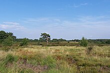
A view at Kintrishi National Park
The South Caucasian nation of Georgia is home to several protected areas, which receive protection because of their environmental, cultural or similar value. The oldest of these – now known as the Lagodekhi Protected Areas – dates back to 1912, when Georgia was part of the Russian Empire.
The total area of Georgia's protected terrestrial territories is 6,501 km2 (2,510 sq mi), which amounts to approximately 9.29% of the country's territory. In addition 153 km2 (59 sq mi) of marine area protected, or 0.67% of the country's territorial waters. There are a total of 89 protected areas, including 14 Strict Nature Reserves, 12 National Parks, 20 Managed Nature Reserves, 40 Natural Monuments, 2 Ramsar sites and 1 Protected Landscape. Strict nature reserves comprise 140,672 ha, while national parks cover 276,724 ha. The total number of visitors to Georgia's protected areas was just under 1.2 million in 2019. (Full article...) -

Cranes at Sevan National Park
This is a list of protected areas in Armenia that are categorized as follows: 4 national parks, 3 state reserves, 27 state sanctuaries and 5 botanical gardens. (Full article...) -
Protected areas in the U.S. State of Ohio include national forest lands, Army Corps of Engineers areas, state parks, state forests, state nature preserves, state wildlife management areas, and other areas. (Full article...)
-

Wales, a country that is part of the United Kingdom, contains protected areas under various designations. The largest designation by land area is Wales' three national parks, followed by the five Areas of Outstanding Natural Beauty (sometimes collectively the "Designated Landscapes of Wales").
Among these protected areas is Snowdonia (Eryri), Wales' first and the UK's third designated national park, and the Gower AONB covering parts of the Gower Peninsula being both Wales' and the UK's first Area of Outstanding Natural Beauty (AONB), as well as smaller designations. (Full article...) -
The protected areas of Nepal cover mainly forested land and are located at various altitudes in the Terai, in the foothills of the Himalayas and in the mountains, thus encompassing a multitude of landscapes and preserving a vast biodiversity in the Palearctic and Indomalayan realms.
Nepal covers 147,181 km2 (56,827 sq mi) in the central part of the Himalayas. Altitudes range from 67 m (220 ft) in the south-eastern Terai to 8,848 m (29,029 ft) at Mount Everest within a short horizontal span. This extreme altitudinal gradient has resulted in 11 bio-climatic zones ranging from lower tropical below 500 m (1,600 ft) to nival above 5,000 m (16,000 ft) in the High Himalayas, encompassing nine terrestrial ecoregions with 36 vegetation types.
Additionally, nine Ramsar sites were declared between 1988 and 2008. Two wildlife reserves were declared as national parks in 2017. (Full article...) -
Heathland at the Hoge Kempen National Park
There are numerous protected areas in Belgium with a wide variety of types, protection levels and sizes. The below list gives an overview of the most important protected areas. (Full article...) -
Protected areas of Estonia are regulated by the Nature Conservation Act (Estonian: Looduskaitseseadus), which was passed by the Estonian parliament on April 21, 2004 and entered into force May 10, 2004.
Overall Estonia has 15403 protected areas covering 21% of the country land and 18% of it marine and coastal territory, including 6 national parks: Lahemaa National Park, Karula National Park, Soomaa National Park,Vilsandi National Park, Matsalu National Park, and Alutaguse National Park (Full article...) -
The Protected areas of New South Wales include both terrestrial and marine protected areas. there are 225 national parks in New South Wales. A number established since the late 1970s followed campaigns by local residents and environmentalists.
Based on the Collaborative Australian Protected Area Database (CAPAD) 2020 data there are 2136 separate terrestrial protected areas with a total land area of 7,696,641 hectares (19,018,810 acres) (9.61% of the state's area). CAPAD data also shows 18 marine protected areas with a total area of 348,849 hectares (862,020 acres), covering 39.63% of NSW waters. (Full article...) -
-
This is a list of protected areas of Afghanistan.
- Ab-i-Estada Nature Reserve, Ghazni Province
- Ajar Valley Nature Reserve, Bamyan Province
- Bamiyan National Heritage Park, Bamyan Province
- Bamiyan Plateau Protected Landscape, Bamyan Province
- Band-e Amir National Park, Bamyan Province
- Darqad (Takhar) Wildlife Reserve, Takhar Province
- Dasht-i-Nawar Waterfowl Sanctuary, Ghazni Province
- Hamun-i-Puzak Waterfowl Sanctuary, Farah and Nimroz provinces
- Imam Sahib (Kunduz) Wildlife Reserve, Kunduz Province
- Khulm Landmark Protected Area, Balkh Province
- Koh-e Baba (Shah Foladi) Protected Landscape, Bamyan province
- Kol-i-Hashmat Khan Waterfowl Sanctuary, Kabul Province
- Northwest Afghanistan Game Managed Reserve, Herat Province
- Nuristan National Park and Wildlife Reserve, Nuristan Province
- Pamir-i-Buzurg Wildlife Reserve, Badakhshan Province
- Registan Desert Wildlife Managed Reserve, Kandahar Province
- Wakhan National Park, Badakhshan Province
- Zadran National Reserve, Paktia Province
-
-
This is a list of protected areas of Saudi Arabia, some of which are managed by the Saudi Wildlife Authority.:
- At-Taysiyah Protected Area
- Jabal Shada Nature Reserve
- Majami'al-Hadb Protected Area
- Nafud al-'Urayq
- Raydah Natural Reserve
- 'Uruq Bani Ma'arid
- Saja Umm Ar-Rimth Natural Reserve
- Harrat al-Harrah Protected Area
- Al-Khunfah Natural Reserve
- Ibex Reserve Protected Area
- Mahazat as-Sayd Protected Area
- Umm al-Qamari Islands
- Al-Tubayq Natural Reserve
- Farasan Islands Protected Area
- Jubail Marine Wildlife Sanctuary
- Jabal Aja Protected Area
- Wadi Turabah Nature Reserve
-
Protected areas of Sri Lanka are administrated by Department of Forest Conservation and Department of Wildlife Conservation of Sri Lanka.There are 501 protected areas in Sri Lanka. The protected areas that fall under supervision of the Department of Forest Conservation include forests defined in National Heritage Wilderness Area Act in 1988, forest reservations, and forests managed for sustainability. Sinharaja Forest Reserve is an example for a National Heritage forest (it is also a World Heritage Site). There are 32 forests categorized as conservation forests including Knuckles Mountain Range. Strict nature reserves, national parks, nature reserves, forest corridors, and sanctuaries recognized under the Flora and Fauna Protection Ordinance are managed by Department of Wildlife Conservation. Total of all protected areas is 1,767,000 ha. Protected areas in Sri Lanka account for 26.5 percent of the total area. This is a higher percentage of protected areas than in all of Asia and much of the World. (Full article...)
-
A National Biodiversity Conservation Area (NBCA) is an environmentally protected area in Laos. There are all together 21 different NBCAs in Laos, protecting 29,775 square kilometers. Another 10 NBCAs have been proposed, many of them being treated by authorities as though they were already officially protected. (Full article...)
-

A family of Asiatic lions at Gir National Park
The Gujarat state of western India has four National Parks and twenty-three wildlife sanctuaries which are managed by the Forest Department of the Government of Gujarat. (Full article...)


.svg)


Selected world maps
-
 Mollweide projection of the world
 -
 United Nations Human Development Index map by country (2016)
 -
 Index map from the International Map of the World (1:1,000,000 scale)
 -
 The Goode homolosine projection is a pseudocylindrical, equal-area, composite map projection used for world maps.
 -
 Only a few of the largest large igneous provinces appear (coloured dark purple) on this geological map, which depicts crustal geologic provinces as seen in seismic refraction data
 -
 1516 map of the world by Martin Waldseemüller
 -
 The world map by Gerardus Mercator (1569), the first map in the well-known Mercator projection
 -
 Time zones of the world
 -
 A plate tectonics map with volcano locations indicated with red circles


World records
- List of Olympic records in athletics
- List of world records in athletics
- List of junior world records in athletics
- List of world records in masters athletics
- List of world youth bests in athletics
- List of IPC world records in athletics
- List of world records in canoeing
- List of world records in chess
- List of cycling records
- List of world records in track cycling
- List of world records in finswimming
- List of world records in juggling
- List of world records in rowing
- List of world records in speed skating
- List of world records in swimming
- List of IPC world records in swimming
- List of world records in Olympic weightlifting
Topics

Continents of Earth | ||||||||
|---|---|---|---|---|---|---|---|---|
| ||||||||
| ||||||||
| ||||||||


| Cenozoic Era (present–66.0 Ma) |
| ||||||||||||
|---|---|---|---|---|---|---|---|---|---|---|---|---|---|
| Mesozoic Era (66.0–252 Ma) |
| ||||||||||||
| Paleozoic Era (252–539 Ma) |
| ||||||||||||
| Proterozoic Eon (539 Ma–2.5 Ga) |
| ||||||||||||
| Archean Eon (2.5–4 Ga) | |||||||||||||
| Hadean Eon (4–4.6 Ga) | |||||||||||||
ka = kiloannum (thousands years ago); Ma = megaannum (millions years ago); Ga = gigaannum (billions years ago). See also: Geologic time scale • | |||||||||||||
| Locations | ||
|---|---|---|
| Related | ||

| |||||||||||||||||||
| |||||||||||||||||||
| |||||||||||||||||||

Economic classification of countries | |||||
|---|---|---|---|---|---|
| Three-World Model | |||||
| Gross domestic product (GDP) |
| ||||
| Gross national income (GNI) | |||||
| Wages | |||||
| Wealth | |||||
| Other national accounts | |||||
| Human development | |||||
| Digital divide | |||||
| Net international investment position (NIIP) | |||||
| Technological |
| ||||
|---|---|---|---|---|---|
| Sociological | |||||
| Ecological |
| ||||
| Biological |
| ||||
| Astronomical | |||||
| Eschatological |
| ||||
| Others |
| ||||
| Fictional | |||||
| Organizations | |||||
Categories

Wikimedia
The following Wikimedia Foundation sister projects provide more on this subject:
-
 Commons
Free media repository -
 Wikibooks
Free textbooks and manuals -
 Wikidata
Free knowledge base -
 Wikinews
Free-content news -
 Wikiquote
Collection of quotations -
 Wikisource
Free-content library -
 Wikispecies
Directory of species -
 Wikiversity
Free learning tools -
 Wikivoyage
Free travel guide -
 Wiktionary
Dictionary and thesaurus


