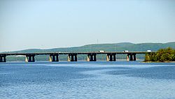
Île aux Tourtes Bridge
Île aux Tourtes Bridge | |
|---|---|
 | |
| Coordinates | 45°25′11″N 73°59′32″W / 45.4196°N 73.9921°W |
| Carries | Quebec Autoroute 40 |
| Crosses | Lake of Two Mountains |
| Locale | Vaudreuil, Quebec |
| Official name | Pont de l'Île aux Tourtes |
| Characteristics | |
| Total length | 2 km (1.2 mi) |
| History | |
| Opened | 1966 |
| Location | |
 | |
The Île aux Tourtes Bridge is a bridge on the western tip of the Island of Montreal, spanning the Lake of Two Mountains between Senneville, and Vaudreuil-Dorion, Quebec, Canada. It carries 6 lanes of Autoroute 40 and is the main link between Montreal and the province of Ontario. At 2 km in length,[1] it is by far the longest bridge in Quebec to cross a body of water other than the Saint Lawrence.[citation needed]
See also
References
- ^ Genivar (2004). "Île-aux-Tourtes Bridge Repair, Montreal, Vaudreuil". Retrieved 2007-11-19.
45°25′10.4″N 73°59′31.6″W / 45.419556°N 73.992111°W
