
's-Heer Hendrikskinderen
's-Heer Hendrikskinderen | |
|---|---|
Village | |
_(1).JPG) Protestant church | |
 Coat of arms | |
 's-Heer Hendrikskinderen Location in the province of Zeeland in the Netherlands  's-Heer Hendrikskinderen 's-Heer Hendrikskinderen (Netherlands)  's-Heer Hendrikskinderen 's-Heer Hendrikskinderen (Europe) | |
| Coordinates: 51°30′6″N 3°51′38″E / 51.50167°N 3.86056°E | |
| Country | Netherlands |
| Province | Zeeland |
| Municipality | Goes |
| Area | |
| • Total | 9.52 km2 (3.68 sq mi) |
| Elevation | 0.9 m (3.0 ft) |
| Population (2021)[1] | |
| • Total | 1,295 |
| • Density | 140/km2 (350/sq mi) |
| Time zone | UTC+1 (CET) |
| • Summer (DST) | UTC+2 (CEST) |
| Postal code | 4472[1] |
| Dialing code | 0113 |
's-Heer Hendrikskinderen is a village in the Dutch province of Zeeland. It is located in the municipality of Goes, about 2 km to the west of the city of Goes.
History
The village was first mentioned in 1267 as Ecclesiam Henrici, and means "(private) church of Lord Henric" and is probably a reference to Henricus de Scinge.[3] 's-Heer Hendrikskinderen is a circular village around a church which developed in the Late Middle Ages.[4]
The Dutch Reformed church dates from the 15th century. The tower is probably incomplete. The current church was built in 1805.[4] Castle Heer Hendriksburg used to be located near the village. In the 18th century, it was rebuilt as an inn, and was demolished in 1803.[5]
's-Heer Hendrikskinderen was home to 137 people in 1840.[5] 's-Heer Hendrikskinderen was a separate municipality until 1857,[6] when it was merged into 's-Heer Arendskerke. In 1970, it became part of the municipality of Goes.[5]
Gallery
-
 Castle near 's-Heer Hendrikskinderen (1710-1735)
 -
 Cat mural in 's-Heer Hendrikskinderen
 -
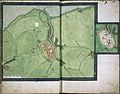 On this 16-century chart of Goes, "Zeer Henriks kinderen" appears in the bottom left corner


References
- ^ a b c "Kerncijfers wijken en buurten 2021". Central Bureau of Statistics. Retrieved 19 April 2022.
- ^ "Postcodetool for 4472AA". Actueel Hoogtebestand Nederland (in Dutch). Het Waterschapshuis. Retrieved 19 April 2022.
- ^ "Heer Hendrikskinderen - (geografische naam)". Etymologiebank (in Dutch). Retrieved 19 April 2022.
- ^ a b Piet van Cruyningen & Ronald Stenvert (2003). 's-Heer Arendskerke (in Dutch). Zwolle: Waanders. ISBN 90 400 8830 6. Retrieved 19 April 2022.
- ^ a b c "'s-Heer Hendrikskinderen". Plaatsengids (in Dutch). Retrieved 19 April 2022.
- ^ Ad van der Meer and Onno Boonstra, Repertorium van Nederlandse gemeenten, KNAW, 2011.
This article about a location in Zeeland is a stub. You can help Wikipedia by expanding it. |