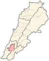
Aadchit El Chqif
Appearance
Aadchit El Chqif
عدشيت الشقيف | |
|---|---|
| Coordinates: 33°20′44.88″N 35°25′18.12″E / 33.3458000°N 35.4217000°E | |
| Grid position | 120/157 L |
| Country | |
| Governorate | Nabatieh Governorate |
| District | Nabatieh District |
| Time zone | UTC+2 (EET) |
| • Summer (DST) | +3 |
Aadchit El Chqif (Arabic: عدشيت الشقيف), or simply Aadchit (Arabic: عدشيت), is a village in the Nabatieh Governorate region of southern Lebanon located north of the Litani River.
History
In 1875, Victor Guérin found it to be a village of 350 Metualis. The villagers had a mosque.[1]
References
Bibliography
- Guérin, V. (1880). Description Géographique Historique et Archéologique de la Palestine (in French). Vol. 3: Galilee, pt. 2. Paris: L'Imprimerie Nationale.
External links
- Aadchit Ech Chaqif, Localiban


