Al-Wazireya

Coordinates: 33°22′N 44°23′E / 33.367°N 44.383°E / 33.367; 44.383
From Wikipedia, the free encyclopedia

This is the current revision of this page, as edited by BattyBot (talk | contribs) at 04:15, 26 January 2021 (Replaced {{unreferenced}} with {{more citations needed}} and other General fixes). The present address (URL) is a permanent link to this version.

(diff) ← Previous revision | Latest revision (diff) | Newer revision → (diff)

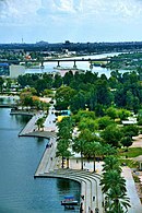
Al-Wazireya or Waziriyah (Arabic: الوزيرية)[1] is a neighborhood in the Adhamiyah District of Baghdad, Iraq. It is at one end of the Al-Sarafiya bridge, across the Tigris River from Utafiyah.

References[edit]

  1. ^ "Al Wazīrīyah Geo name". geonames.org.

33°22′N 44°23′E / 33.367°N 44.383°E / 33.367; 44.383