Arrubium
Appearance
| Arrubium | |
|---|---|
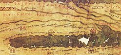
 Appearing as Arrubio in Tabula Peutingeriana | |
| Alternative name(s) | Arrubio |
| Known also as | Castra of Măcin |
| Attested by | Tabula Peutingeriana |
| Place in the Roman world | |
| Province | Moesia |
| Administrative unit | Moesia Inferior |
| Directly connected to | |
| Stationed military units | |
| — Legions — | |
| V Macedonica | |
| — Alae — | |
| Location | |
| Coordinates | 45°14′20″N 28°07′40″E / 45.2388°N 28.1277°E |
| Altitude | c. 17 m |
| Town | Măcin |
| County | Tulcea |
| Country | |
| Reference | |
| RO-RAN | 159749.03 [1] |
| Site notes | |
| Condition | Ruined |
Arrubium was a fort in the Roman province of Moesia (today's Măcin, Romania).
See also
References
- Oberländer-Târnoveanu, Ernest: Aspecte ale circulaţiei monetare greceşti în Dobrogea de Nord (sec. VI î.e.n - I e.n), Pontica, IX, Constanţa, 1978, p. 59-87.
- Florescu, Radu: Limesul dunărean bizantin în vremea dinastiilor isauriană şi macedoneană, Pontica, XIX, Constanţa, 1986, p. 172.
Notes
- ^ "Fortificația romano-bizantină de la Măcin". National Archaeological Record of Romania (RAN). ran.cimec.ro. 2009-09-21. Archived from the original on 2016-03-03. Retrieved 2013-01-04.
External links
- Roman castra from Romania - Google Maps / Earth Archived 2012-12-05 at archive.today
Wikimedia Commons has media related to Arrubium (castra).

