
Bad Laer
Bad Laer | |
|---|---|
 Coat of arms | |
Location of Bad Laer within Osnabrück district 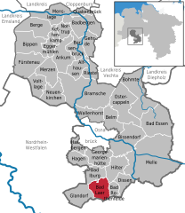 | |
| Country | Germany |
| State | Lower Saxony |
| District | Osnabrück |
| Government | |
| • Mayor | Holger Richard (CDU) |
| Area | |
| • Total | 46.85 km2 (18.09 sq mi) |
| Elevation | 79 m (259 ft) |
| Population (2022-12-31)[1] | |
| • Total | 9,221 |
| • Density | 200/km2 (510/sq mi) |
| Time zone | UTC+01:00 (CET) |
| • Summer (DST) | UTC+02:00 (CEST) |
| Postal codes | 49196 |
| Dialling codes | 05424 |
| Vehicle registration | OS |
| Website | www.bad-laer.de |

Bad Laer is a municipality and health resort in the district of Osnabrück, in Lower Saxony, Germany. It is situated in the Teutoburg Forest, approx. 20 km south of Osnabrück.
The municipality includes Bad Laer and five outlying districts Remsede, Müschen, Hardensetten, Westerwiede and Winkelsetten.
References

This Osnabrück district location article is a stub. You can help Wikipedia by expanding it. |