Balgowan, South Australia
This article needs additional citations for verification. (October 2015) |
| Balgowan South Australia | |||||||||||||||
|---|---|---|---|---|---|---|---|---|---|---|---|---|---|---|---|
| Coordinates | 34°20′S 137°29′E / 34.333°S 137.483°E | ||||||||||||||
| Population | 312 (shared with other localities in the "State Suburb of Balgowan") (2011 census)[1] | ||||||||||||||
| Established | 1878[2] | ||||||||||||||
| Postcode(s) | 5573[3] | ||||||||||||||
| Location |
| ||||||||||||||
| LGA(s) | Yorke Peninsula Council | ||||||||||||||
| Region | Yorke and Mid North[4] | ||||||||||||||
| County | Daly[2] Fergusson[2] | ||||||||||||||
| State electorate(s) | Narungga[5] | ||||||||||||||
| Federal division(s) | Grey[6] | ||||||||||||||
| |||||||||||||||
| |||||||||||||||
| Footnotes | Distances[3] Coordinates[2] Climate[7] Adjoining localities[2] | ||||||||||||||
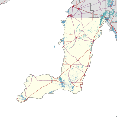
Balgowan is a small coastal town on the west coast of South Australia's Yorke Peninsula. It is located approximately 20 kilometres (12 miles) west of Maitland. Like other towns on popular with tourists on Yorke Peninsula, it has a large number of shacks, holiday houses, caravan facilities and a boat ramp. The population generally increases during peak holiday periods.
The government town of Balgowan was surveyed in September 1878 and was named after a town located in Perthshire, Scotland. Boundaries were created for the locality also known as Balgowan in May 1999 and which include the former government town and the Tiparra Shack Site.[2][8]
Balgowan's only shop is a general store. The store closed in August 2011 and reopened late 2013.
Balgowan is located within the federal division of Grey, the state electoral district of Narungga and the local government area of the Yorke Peninsula Council.[2][6][5]
See also
References
- ^ Australian Bureau of Statistics (31 October 2012). "Balgowan". 2011 Census QuickStats. Retrieved 6 April 2016.
- ^ a b c d e f g "Search results for "Balgowan (Locality Bounded)" (Record no SA0004341) with the following layers being selected - "Suburbs and Localities", "Counties", "Local Government Areas" and "Road Labels"". Government of South Australia. Retrieved 6 April 2016.
- ^ a b "Balgowan, South Australia (Postcode)". postcodes-australia.com. Retrieved 6 April 2016.
- ^ "Yorke and Mid North SA Government region" (PDF). The Government of South Australia. Retrieved 17 April 2017.
- ^ a b Narungga (Map). Electoral District Boundaries Commission. 2016. Retrieved 1 March 2018.
- ^ a b "Federal electoral division of Grey" (PDF). Australian Electoral Commission. Retrieved 24 July 2015.
- ^ "Monthly climate statistics: Summary statistics MAITLAND (nearest station)". Commonwealth of Australia , Bureau of Meteorology. Retrieved 6 April 2016.
- ^ "Search result for "Balgowan" (Record no SA0042682) with the following layer being selected - "Suburbs and Localities" and "Government Towns"". Department of Planning, Transport and Infrastructure. Archived from the original on 12 October 2016. Retrieved 6 April 2016.

