Bambous, Mauritius
Appearance
Bambous | |
|---|---|
Village | |
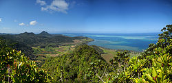
 Bambous Mountains | |
| Coordinates: 20°15′36″S 57°24′53.4″E / 20.26000°S 57.414833°E | |
| Country | |
| Districts | Rivière Noire District |
| Government | |
| Population (2011)[1] | |
| • Total | 15,345 |
| • Density | 702.9/km2 (1,821/sq mi) |
| Time zone | UTC+4 (MUT) |
| Area code | 230 |
| ISO 3166 code | MU |
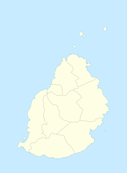
Bambous is a small town in Mauritius located in the Rivière Noire District. The village is administered by the Bambous Village Council under the aegis of the Rivière Noire District Council.[2] According to the census made by Statistics Mauritius in 2011, the population was at 15,345.[1]
Sports
The local football team is the Bambous Etoile de L'ouest S.C, the village host a multi-purpose sports venue, the Stade Germain Comarmond, the venue has hosted various international competitions such as the 2006 African Championships in Athletics and 2009 African Junior Athletics Championships.
See also
References
- ^ a b "Table G1 - Resident population by geographical location, whereabouts on census night and sex" (PDF). Statistics Mauritius. 2011: 3 and 4. Archived from the original (PDF) on 3 March 2016. Retrieved 18 December 2012.
{{cite journal}}: Cite journal requires|journal=(help) - ^ Ministry of Local Government and Outer Islands. "Local Government Act 2011" (PDF). Electoral Commissioner's Office: 791. Archived from the original (PDF) on 5 September 2014. Retrieved 5 September 2014.
{{cite journal}}: Cite journal requires|journal=(help)
Wikimedia Commons has media related to Bambous, Mauritius.

