Blue Hole (Rawley Springs)
This article has multiple issues. Please help improve it or discuss these issues on the talk page. (Learn how and when to remove these template messages)
|
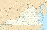
Blue hole refers to a frequented swimming hole just past Rawley Springs, Virginia situated in the Dry River.[note 1] The boundaries of the George Washington National Forest surround the swimming hole.
History[edit]
The Rawley Springs area has a history of European settlers and their descendants, mostly men, purchasing and building vacation stays and fine boarding houses in the area. A series of fires in the 1800s brought these buildings down. Today there is a cluster of homes making up the Rawley Springs area. Commercialization of the area, like building hotels and resorts, is no longer allowed.[1]
The springs, which feed into the Dry River are said to be a place of healing.[1]
Use[edit]
The swimming hole has not been developed with a parking area and easy access, although for some this is also the allure. Most people park on the shoulder of Route 33 just past Rawley Springs heading west. A short but steep climb down to the river follows. The path's location is unmarked but worn enough to be noticeable.
Notes[edit]
- ^ This article is about Blue Hole adjacent to U.S. Route 33. There is a second Blue Hole swimming area near Bergton, VA.
References[edit]
- ^ a b Rafuse, Diane. "Mixing Pleasure and Profit at the Springs: The Harrisonburg-Rawley Connection" (PDF). The Harrisonburg-Rockinham Historical Society Newsletter. 31, 2 Spring 2009: 1, 4–5, 8. Archived (PDF) from the original on 2016-07-29.

