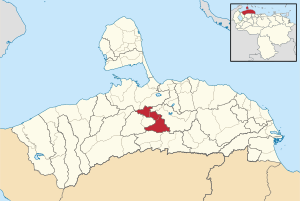
Bolívar Municipality, Falcón
Appearance
Bolívar Municipality
Municipio Bolívar | |
|---|---|
 Location in Miranda | |
| Coordinates: 11°03′45″N 69°37′40″W / 11.0625°N 69.6278°W | |
| Country | |
| State | Miranda |
| Municipal seat | San Luis[*] |
| Area | |
| • Total | 551.4 km2 (212.9 sq mi) |
| Time zone | UTC−4 (VET) |
| Website | Official website |
Bolívar Municipality is a municipality in Falcón State, Venezuela.
Name
[edit]The municipality is one of several in Venezuela named "Bolívar Municipality" in honour of Venezuelan independence hero Simón Bolívar.

